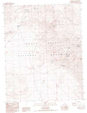
Chloride City Topo Map California
To zoom in, hover over the map of Chloride City
USGS Topo Quad 36116f8 - 1:24,000 scale
| Topo Map Name: | Chloride City |
| USGS Topo Quad ID: | 36116f8 |
| Print Size: | ca. 21 1/4" wide x 27" high |
| Southeast Coordinates: | 36.625° N latitude / 116.875° W longitude |
| Map Center Coordinates: | 36.6875° N latitude / 116.9375° W longitude |
| U.S. State: | CA |
| Filename: | o36116f8.jpg |
| Download Map JPG Image: | Chloride City topo map 1:24,000 scale |
| Map Type: | Topographic |
| Topo Series: | 7.5´ |
| Map Scale: | 1:24,000 |
| Source of Map Images: | United States Geological Survey (USGS) |
| Alternate Map Versions: |
Chloride City CA 1988, updated 1988 Download PDF Buy paper map Chloride City CA 1988, updated 1995 Download PDF Buy paper map Chloride City CA 2012 Download PDF Buy paper map Chloride City CA 2015 Download PDF Buy paper map |
1:24,000 Topo Quads surrounding Chloride City
> Back to 36116e1 at 1:100,000 scale
> Back to 36116a1 at 1:250,000 scale
> Back to U.S. Topo Maps home
Chloride City topo map: Gazetteer
Chloride City: Mines
Big Bell Mine elevation 1104m 3622′Keane Wonder Mill elevation 468m 1535′
Keane Wonder Mine elevation 831m 2726′
Chloride City: Populated Places
Chloride City elevation 1454m 4770′Chloride City: Springs
Hole-in-the Rock Spring elevation 871m 2857′Keane Spring elevation 1198m 3930′
Keane Wonder Springs elevation 379m 1243′
Keane Wonder Springs elevation 329m 1079′
Monarch Spring elevation 916m 3005′
Chloride City: Summits
Chloride Cliff elevation 1594m 5229′Chloride City: Valleys
Boundary Canyon elevation 637m 2089′Monarch Canyon elevation 503m 1650′
Chloride City digital topo map on disk
Buy this Chloride City topo map showing relief, roads, GPS coordinates and other geographical features, as a high-resolution digital map file on DVD:
Southern Sierra Nevada, California & Southern Nevada
Buy digital topo maps: Southern Sierra Nevada, California & Southern Nevada


