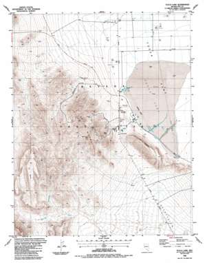
Yucca Lake Topo Map Nevada
To zoom in, hover over the map of Yucca Lake
USGS Topo Quad 36116h1 - 1:24,000 scale
| Topo Map Name: | Yucca Lake |
| USGS Topo Quad ID: | 36116h1 |
| Print Size: | ca. 21 1/4" wide x 27" high |
| Southeast Coordinates: | 36.875° N latitude / 116° W longitude |
| Map Center Coordinates: | 36.9375° N latitude / 116.0625° W longitude |
| U.S. State: | NV |
| Filename: | o36116h1.jpg |
| Download Map JPG Image: | Yucca Lake topo map 1:24,000 scale |
| Map Type: | Topographic |
| Topo Series: | 7.5´ |
| Map Scale: | 1:24,000 |
| Source of Map Images: | United States Geological Survey (USGS) |
| Alternate Map Versions: |
Yucca Lake NV 1961, updated 1962 Download PDF Buy paper map Yucca Lake NV 1961, updated 1984 Download PDF Buy paper map Yucca Lake NV 1986, updated 1987 Download PDF Buy paper map Yucca Lake NV 1986, updated 1987 Download PDF Buy paper map |
1:24,000 Topo Quads surrounding Yucca Lake
> Back to 36116e1 at 1:100,000 scale
> Back to 36116a1 at 1:250,000 scale
> Back to U.S. Topo Maps home
Yucca Lake topo map: Gazetteer
Yucca Lake: Airports
Yucca Airstrip elevation 1195m 3920′Yucca Lake: Benches
The Bench elevation 1466m 4809′Yucca Lake: Gaps
Yucca Pass elevation 1230m 4035′Yucca Lake: Lakes
Yucca Lake elevation 1195m 3920′Yucca Lake: Reservoirs
Railroad Tanks elevation 1196m 3923′Yucca Lake: Streams
Vitrophyre Wash elevation 1189m 3900′Yucca Lake: Summits
C P Hills elevation 1532m 5026′C P Hogback elevation 1366m 4481′
News Nob elevation 1226m 4022′
Yucca Lake: Valleys
C P Canyon elevation 1303m 4274′Yucca Lake: Wells
Well B elevation 1199m 3933′Well C elevation 1196m 3923′
Well Number Three elevation 1210m 3969′
Well Three elevation 1211m 3973′
Yucca Lake digital topo map on disk
Buy this Yucca Lake topo map showing relief, roads, GPS coordinates and other geographical features, as a high-resolution digital map file on DVD:
Southern Sierra Nevada, California & Southern Nevada
Buy digital topo maps: Southern Sierra Nevada, California & Southern Nevada


