Bullfrog Mountain Topo Map Nevada
To zoom in, hover over the map of Bullfrog Mountain
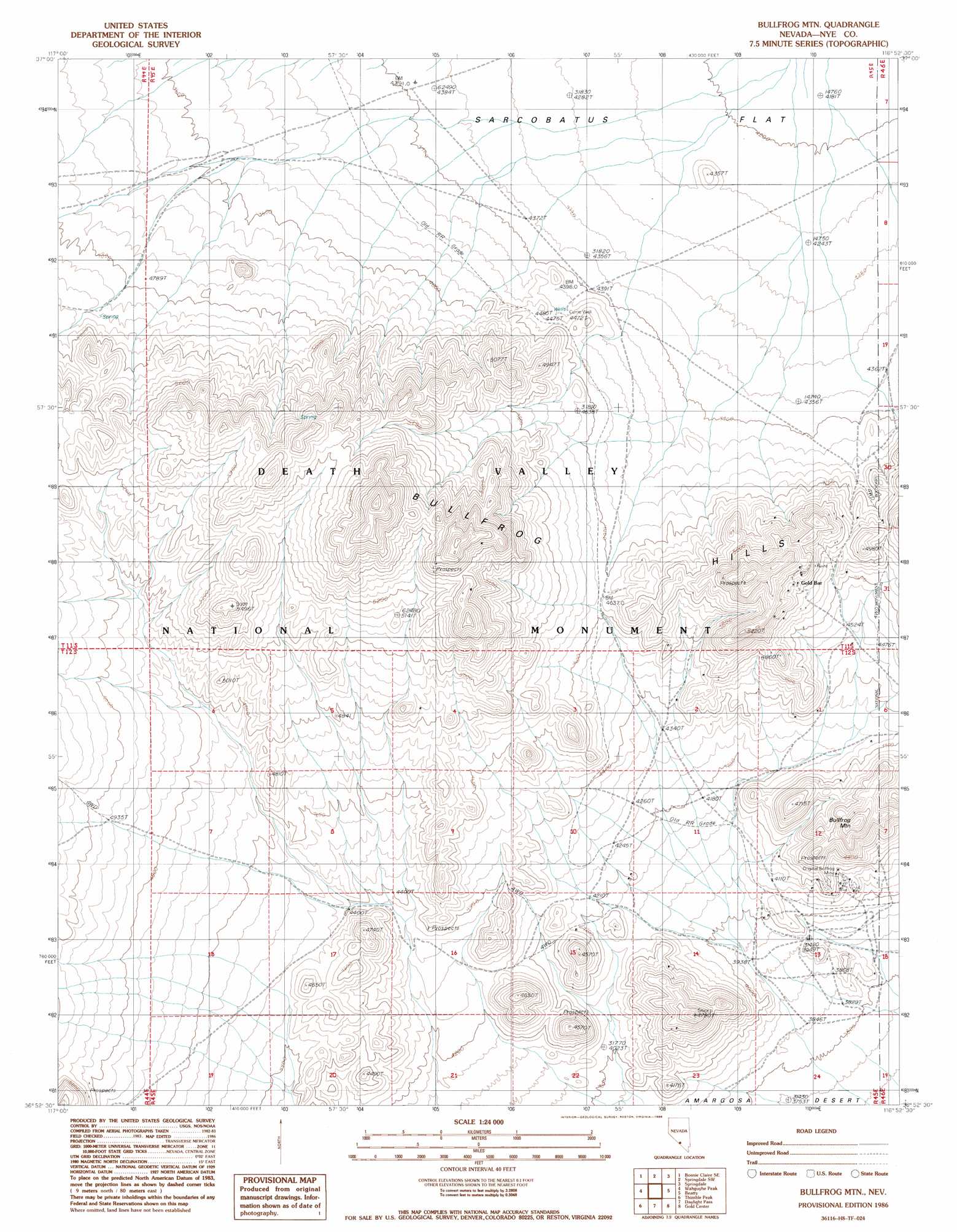
USGS Topo Quad 36116h8 - 1:24,000 scale
| Topo Map Name: | Bullfrog Mountain |
| USGS Topo Quad ID: | 36116h8 |
| Print Size: | ca. 21 1/4" wide x 27" high |
| Southeast Coordinates: | 36.875° N latitude / 116.875° W longitude |
| Map Center Coordinates: | 36.9375° N latitude / 116.9375° W longitude |
| U.S. State: | NV |
| Filename: | o36116h8.jpg |
| Download Map JPG Image: | Bullfrog Mountain topo map 1:24,000 scale |
| Map Type: | Topographic |
| Topo Series: | 7.5´ |
| Map Scale: | 1:24,000 |
| Source of Map Images: | United States Geological Survey (USGS) |
| Alternate Map Versions: |
Bullfrog Mtn. NV 1986, updated 1986 Download PDF Buy paper map Bullfrog Mountain NV 2012 Download PDF Buy paper map Bullfrog Mountain NV 2015 Download PDF Buy paper map |
1:24,000 Topo Quads surrounding Bullfrog Mountain
Bonnie Claire Lake |
Bonnie Claire |
Springdale Nw |
Springdale Ne |
Thirsty Canyon Nw |
Bonnie Claire Sw |
Bonnie Claire Se |
Springdale Sw |
Springdale |
Thirsty Canyon Sw |
Grapevine Peak |
Wahguyhe Peak |
Bullfrog Mountain |
Beatty |
Beatty Mountain |
Fall Canyon |
Thimble Peak |
Daylight Pass |
Gold Center |
Carrara Canyon |
Mesquite Flat |
Stovepipe Wells |
Chloride City |
East Of Chloride City |
Ashton |
> Back to 36116e1 at 1:100,000 scale
> Back to 36116a1 at 1:250,000 scale
> Back to U.S. Topo Maps home
Bullfrog Mountain topo map: Gazetteer
Bullfrog Mountain: Mines
Gold Bar Mine elevation 1518m 4980′Homestake Mine elevation 1536m 5039′
Original Bullfrog Mine elevation 1266m 4153′
Bullfrog Mountain: Populated Places
Gold Bar (historical) elevation 1560m 5118′Original (historical) elevation 1217m 3992′
Bullfrog Mountain: Post Offices
Goldbar Post Office (historical) elevation 1560m 5118′Bullfrog Mountain: Summits
Bullfrog Mountain elevation 1450m 4757′Bullfrog Mountain: Wells
Currie Well elevation 1374m 4507′Bullfrog Mountain digital topo map on disk
Buy this Bullfrog Mountain topo map showing relief, roads, GPS coordinates and other geographical features, as a high-resolution digital map file on DVD:
Southern Sierra Nevada, California & Southern Nevada
Buy digital topo maps: Southern Sierra Nevada, California & Southern Nevada