Petroglyph Canyon Topo Map California
To zoom in, hover over the map of Petroglyph Canyon
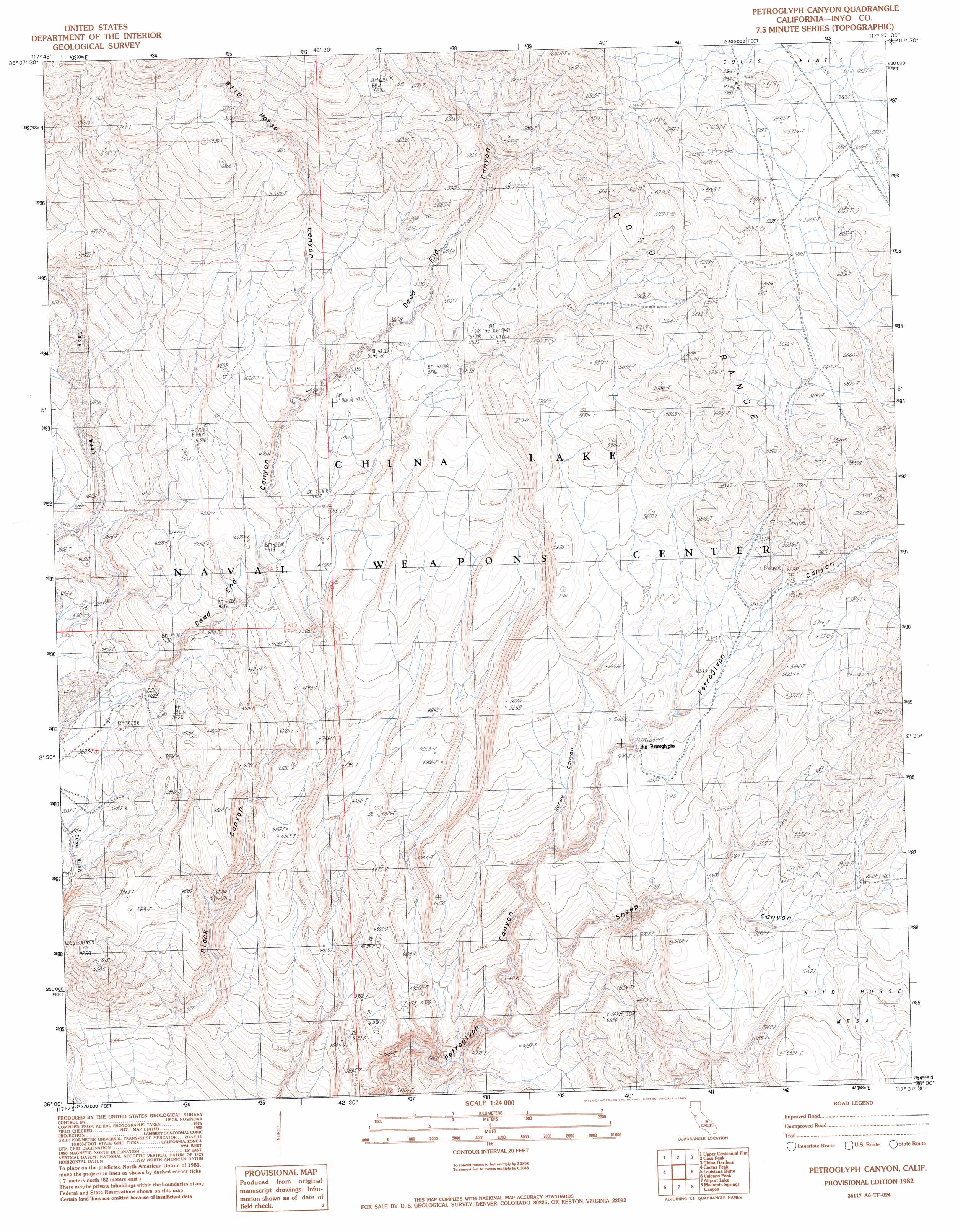
USGS Topo Quad 36117a6 - 1:24,000 scale
| Topo Map Name: | Petroglyph Canyon |
| USGS Topo Quad ID: | 36117a6 |
| Print Size: | ca. 21 1/4" wide x 27" high |
| Southeast Coordinates: | 36° N latitude / 117.625° W longitude |
| Map Center Coordinates: | 36.0625° N latitude / 117.6875° W longitude |
| U.S. State: | CA |
| Filename: | o36117a6.jpg |
| Download Map JPG Image: | Petroglyph Canyon topo map 1:24,000 scale |
| Map Type: | Topographic |
| Topo Series: | 7.5´ |
| Map Scale: | 1:24,000 |
| Source of Map Images: | United States Geological Survey (USGS) |
| Alternate Map Versions: |
Petroglyph Canyon CA 1982, updated 1983 Download PDF Buy paper map Petroglyph Canyon CA 2012 Download PDF Buy paper map Petroglyph Canyon CA 2015 Download PDF Buy paper map |
1:24,000 Topo Quads surrounding Petroglyph Canyon
Vermillion Canyon |
Centennial Canyon |
Talc City Hills |
Darwin |
Panamint Springs |
Haiwee Reservoirs |
Upper Centennial Flat |
Coso Peak |
China Gardens |
Revenue Canyon |
Coso Junction |
Cactus Peak |
Petroglyph Canyon |
Louisiana Butte |
Maturango Peak |
Little Lake |
Volcano Peak |
Airport Lake |
Mountain Springs Canyon |
Homewood Canyon |
Ninemile Canyon |
Pearsonville |
White Hills |
Burro Canyon |
Trona West |
> Back to 36117a1 at 1:100,000 scale
> Back to 36116a1 at 1:250,000 scale
> Back to U.S. Topo Maps home
Petroglyph Canyon topo map: Gazetteer
Petroglyph Canyon: Summits
Wild Horse Mesa elevation 1653m 5423′Petroglyph Canyon: Valleys
Dead End Canyon elevation 1120m 3674′Horse Canyon elevation 1438m 4717′
Sheep Canyon elevation 1237m 4058′
Wild Horse Canyon elevation 1447m 4747′
Petroglyph Canyon digital topo map on disk
Buy this Petroglyph Canyon topo map showing relief, roads, GPS coordinates and other geographical features, as a high-resolution digital map file on DVD:
Southern Sierra Nevada, California & Southern Nevada
Buy digital topo maps: Southern Sierra Nevada, California & Southern Nevada