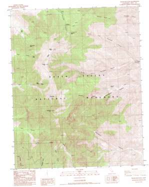
Telescope Peak Topo Map California
To zoom in, hover over the map of Telescope Peak
USGS Topo Quad 36117b1 - 1:24,000 scale
| Topo Map Name: | Telescope Peak |
| USGS Topo Quad ID: | 36117b1 |
| Print Size: | ca. 21 1/4" wide x 27" high |
| Southeast Coordinates: | 36.125° N latitude / 117° W longitude |
| Map Center Coordinates: | 36.1875° N latitude / 117.0625° W longitude |
| U.S. State: | CA |
| Filename: | o36117b1.jpg |
| Download Map JPG Image: | Telescope Peak topo map 1:24,000 scale |
| Map Type: | Topographic |
| Topo Series: | 7.5´ |
| Map Scale: | 1:24,000 |
| Source of Map Images: | United States Geological Survey (USGS) |
| Alternate Map Versions: |
Telescope Peak CA 1988, updated 1988 Download PDF Buy paper map Telescope Peak CA 1998, updated 2002 Download PDF Buy paper map Telescope Peak CA 2012 Download PDF Buy paper map Telescope Peak CA 2015 Download PDF Buy paper map |
1:24,000 Topo Quads surrounding Telescope Peak
> Back to 36117a1 at 1:100,000 scale
> Back to 36116a1 at 1:250,000 scale
> Back to U.S. Topo Maps home
Telescope Peak topo map: Gazetteer
Telescope Peak: Flats
Arcane Meadows elevation 2939m 9642′Mahogany Flat elevation 2415m 7923′
Telescope Peak: Ranges
Panamint Range elevation 3369m 11053′Telescope Peak: Ridges
Colville Ridge elevation 2309m 7575′Coville Ridge elevation 2283m 7490′
Telescope Peak: Springs
Birch Spring elevation 2302m 7552′Eagle Spring elevation 2874m 9429′
Hanaupah Spring elevation 1241m 4071′
Hummingbird Spring elevation 2239m 7345′
Jail Spring elevation 2489m 8166′
Tuber Spring elevation 2350m 7709′
Telescope Peak: Summits
Bennett Peak elevation 3027m 9931′Piñon Mesa elevation 1880m 6167′
Rogers Peak elevation 3045m 9990′
Telescope Peak elevation 3369m 11053′
Telescope Peak: Valleys
Middle Fork Hanaupah Canyon elevation 962m 3156′North Fork Hanaupah Canyon elevation 1002m 3287′
Telescope Peak digital topo map on disk
Buy this Telescope Peak topo map showing relief, roads, GPS coordinates and other geographical features, as a high-resolution digital map file on DVD:
Southern Sierra Nevada, California & Southern Nevada
Buy digital topo maps: Southern Sierra Nevada, California & Southern Nevada


