The Dunes Topo Map California
To zoom in, hover over the map of The Dunes
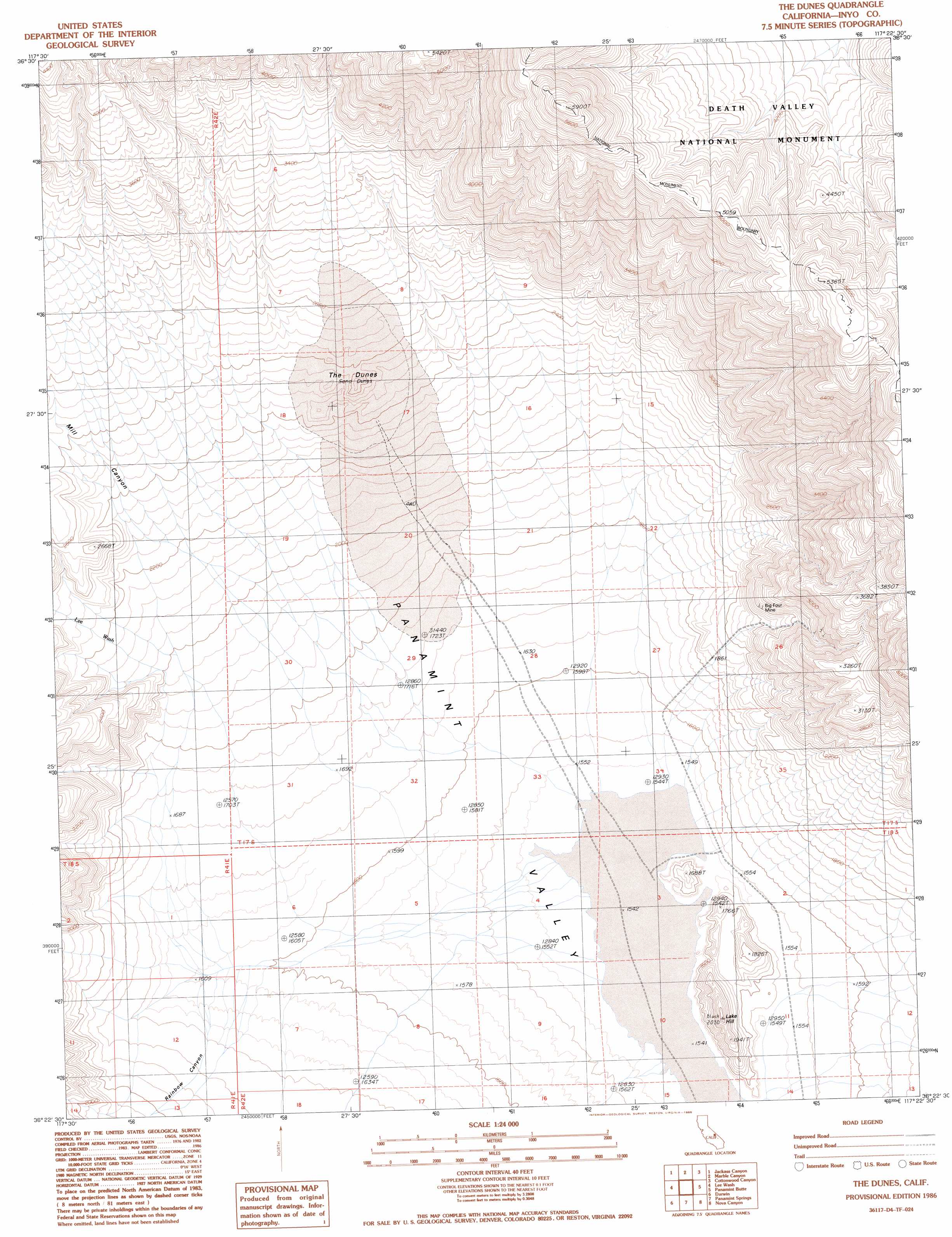
USGS Topo Quad 36117d4 - 1:24,000 scale
| Topo Map Name: | The Dunes |
| USGS Topo Quad ID: | 36117d4 |
| Print Size: | ca. 21 1/4" wide x 27" high |
| Southeast Coordinates: | 36.375° N latitude / 117.375° W longitude |
| Map Center Coordinates: | 36.4375° N latitude / 117.4375° W longitude |
| U.S. State: | CA |
| Filename: | o36117d4.jpg |
| Download Map JPG Image: | The Dunes topo map 1:24,000 scale |
| Map Type: | Topographic |
| Topo Series: | 7.5´ |
| Map Scale: | 1:24,000 |
| Source of Map Images: | United States Geological Survey (USGS) |
| Alternate Map Versions: |
The Dunes CA 1986, updated 1986 Download PDF Buy paper map The Dunes CA 2012 Download PDF Buy paper map The Dunes CA 2015 Download PDF Buy paper map |
1:24,000 Topo Quads surrounding The Dunes
West Of Ubehebe Peak |
Ubehebe Peak |
Sand Flat |
East Of Sand Flat |
Mesquite Flat |
Nelson Range |
Jackass Canyon |
Harris Hill |
Cottonwood Canyon |
Stovepipe Wells Village |
Santa Rosa Flat |
Lee Wash |
The Dunes |
Panamint Butte |
Emigrant Canyon |
Talc City Hills |
Darwin |
Panamint Springs |
Nova Canyon |
Emigrant Pass |
Coso Peak |
China Gardens |
Revenue Canyon |
Maturango Peak Ne |
Jail Canyon |
> Back to 36117a1 at 1:100,000 scale
> Back to 36116a1 at 1:250,000 scale
> Back to U.S. Topo Maps home
The Dunes topo map: Gazetteer
The Dunes: Mines
Big Four Mine elevation 890m 2919′The Dunes: Streams
Lee Wash elevation 596m 1955′The Dunes: Summits
Lake Hill elevation 618m 2027′The Dunes elevation 795m 2608′
The Dunes: Valleys
Mill Canyon elevation 670m 2198′The Dunes digital topo map on disk
Buy this The Dunes topo map showing relief, roads, GPS coordinates and other geographical features, as a high-resolution digital map file on DVD:
Southern Sierra Nevada, California & Southern Nevada
Buy digital topo maps: Southern Sierra Nevada, California & Southern Nevada