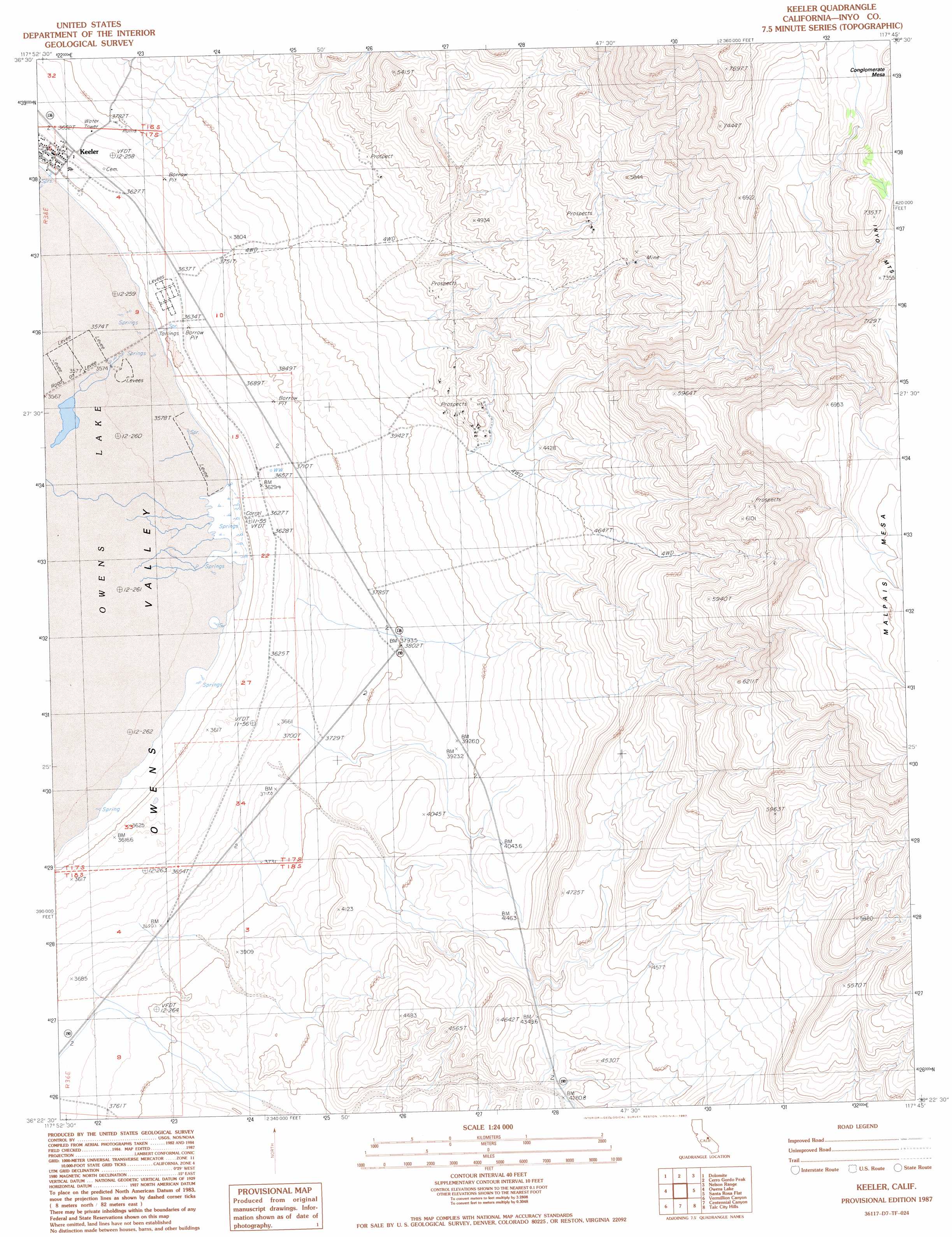
Keeler Topo Map California
To zoom in, hover over the map of Keeler
USGS Topo Quad 36117d7 - 1:24,000 scale
| Topo Map Name: | Keeler |
| USGS Topo Quad ID: | 36117d7 |
| Print Size: | ca. 21 1/4" wide x 27" high |
| Southeast Coordinates: | 36.375° N latitude / 117.75° W longitude |
| Map Center Coordinates: | 36.4375° N latitude / 117.8125° W longitude |
| U.S. State: | CA |
| Filename: | o36117d7.jpg |
| Download Map JPG Image: | Keeler topo map 1:24,000 scale |
| Map Type: | Topographic |
| Topo Series: | 7.5´ |
| Map Scale: | 1:24,000 |
| Source of Map Images: | United States Geological Survey (USGS) |
| Alternate Map Versions: |
Keeler CA 1987, updated 1987 Download PDF Buy paper map Keeler CA 1987, updated 1987 Download PDF Buy paper map Keeler CA 2012 Download PDF Buy paper map Keeler CA 2015 Download PDF Buy paper map |
1:24,000 Topo Quads surrounding Keeler
Union Wash |
New York Butte |
Craig Canyon |
West Of Ubehebe Peak |
Ubehebe Peak |
Lone Pine |
Dolomite |
Cerro Gordo Peak |
Nelson Range |
Jackass Canyon |
Bartlett |
Owens Lake |
Keeler |
Santa Rosa Flat |
Lee Wash |
Olancha |
Vermillion Canyon |
Centennial Canyon |
Talc City Hills |
Darwin |
Haiwee Pass |
Haiwee Reservoirs |
Upper Centennial Flat |
Coso Peak |
China Gardens |
> Back to 36117a1 at 1:100,000 scale
> Back to 36116a1 at 1:250,000 scale
> Back to U.S. Topo Maps home
Keeler digital topo map on disk
Buy this Keeler topo map showing relief, roads, GPS coordinates and other geographical features, as a high-resolution digital map file on DVD:
Southern Sierra Nevada, California & Southern Nevada
Buy digital topo maps: Southern Sierra Nevada, California & Southern Nevada