Cottonwood Canyon Topo Map California
To zoom in, hover over the map of Cottonwood Canyon
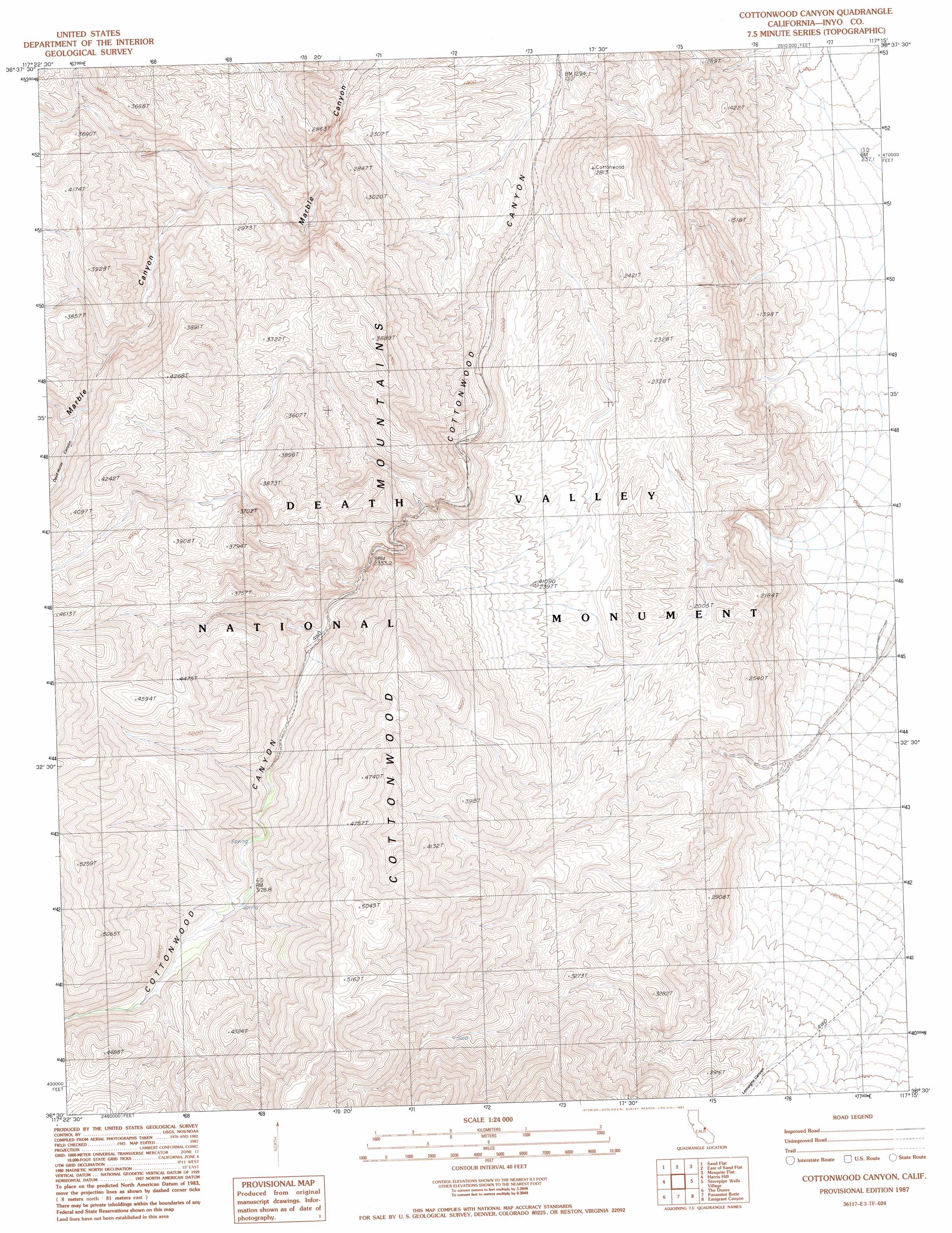
USGS Topo Quad 36117e3 - 1:24,000 scale
| Topo Map Name: | Cottonwood Canyon |
| USGS Topo Quad ID: | 36117e3 |
| Print Size: | ca. 21 1/4" wide x 27" high |
| Southeast Coordinates: | 36.5° N latitude / 117.25° W longitude |
| Map Center Coordinates: | 36.5625° N latitude / 117.3125° W longitude |
| U.S. State: | CA |
| Filename: | o36117e3.jpg |
| Download Map JPG Image: | Cottonwood Canyon topo map 1:24,000 scale |
| Map Type: | Topographic |
| Topo Series: | 7.5´ |
| Map Scale: | 1:24,000 |
| Source of Map Images: | United States Geological Survey (USGS) |
| Alternate Map Versions: |
Cottonwood Canyon CA 1987, updated 1987 Download PDF Buy paper map Cottonwood Canyon CA 1987, updated 1987 Download PDF Buy paper map Cottonwood Canyon CA 2012 Download PDF Buy paper map Cottonwood Canyon CA 2015 Download PDF Buy paper map |
1:24,000 Topo Quads surrounding Cottonwood Canyon
Teakettle Junction |
White Top Mountain |
Dry Bone Canyon |
Fall Canyon |
Thimble Peak |
Ubehebe Peak |
Sand Flat |
East Of Sand Flat |
Mesquite Flat |
Stovepipe Wells |
Jackass Canyon |
Harris Hill |
Cottonwood Canyon |
Stovepipe Wells Village |
Grotto Canyon |
Lee Wash |
The Dunes |
Panamint Butte |
Emigrant Canyon |
Tucki Wash |
Darwin |
Panamint Springs |
Nova Canyon |
Emigrant Pass |
Wildrose Peak |
> Back to 36117e1 at 1:100,000 scale
> Back to 36116a1 at 1:250,000 scale
> Back to U.S. Topo Maps home
Cottonwood Canyon topo map: Gazetteer
Cottonwood Canyon: Ranges
Cottonwood Mountains elevation 1180m 3871′Cottonwood Canyon: Valleys
Dead Horse Canyon elevation 964m 3162′Lemoigne Canyon elevation 674m 2211′
Cottonwood Canyon digital topo map on disk
Buy this Cottonwood Canyon topo map showing relief, roads, GPS coordinates and other geographical features, as a high-resolution digital map file on DVD:
Southern Sierra Nevada, California & Southern Nevada
Buy digital topo maps: Southern Sierra Nevada, California & Southern Nevada