Stovepipe Wells Topo Map California
To zoom in, hover over the map of Stovepipe Wells
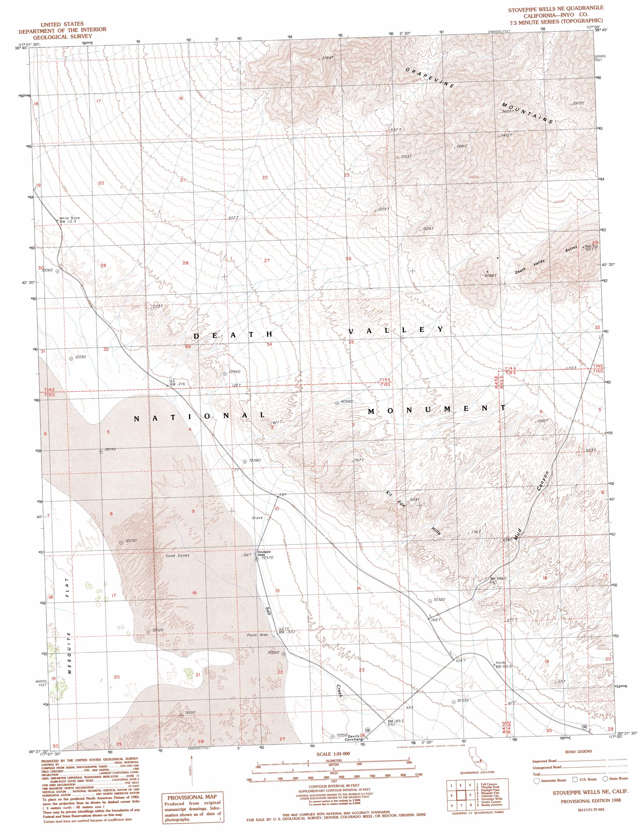
USGS Topo Quad 36117f1 - 1:24,000 scale
| Topo Map Name: | Stovepipe Wells |
| USGS Topo Quad ID: | 36117f1 |
| Print Size: | ca. 21 1/4" wide x 27" high |
| Southeast Coordinates: | 36.625° N latitude / 117° W longitude |
| Map Center Coordinates: | 36.6875° N latitude / 117.0625° W longitude |
| U.S. State: | CA |
| Filename: | o36117f1.jpg |
| Download Map JPG Image: | Stovepipe Wells topo map 1:24,000 scale |
| Map Type: | Topographic |
| Topo Series: | 7.5´ |
| Map Scale: | 1:24,000 |
| Source of Map Images: | United States Geological Survey (USGS) |
| Alternate Map Versions: |
Stovepipe Wells NE CA 1988, updated 1988 Download PDF Buy paper map Stovepipe Wells NE CA 2012 Download PDF Buy paper map Stovepipe Wells NE CA 2015 Download PDF Buy paper map |
1:24,000 Topo Quads surrounding Stovepipe Wells
East Of Tin Mountain |
Grapevine Peak |
Wahguyhe Peak |
Bullfrog Mountain |
Beatty |
Dry Bone Canyon |
Fall Canyon |
Thimble Peak |
Daylight Pass |
Gold Center |
East Of Sand Flat |
Mesquite Flat |
Stovepipe Wells |
Chloride City |
East Of Chloride City |
Cottonwood Canyon |
Stovepipe Wells Village |
Grotto Canyon |
Beatty Junction |
Nevares Peak |
Panamint Butte |
Emigrant Canyon |
Tucki Wash |
East Of Furnace Creek |
Furnace Creek |
> Back to 36117e1 at 1:100,000 scale
> Back to 36116a1 at 1:250,000 scale
> Back to U.S. Topo Maps home
Stovepipe Wells topo map: Gazetteer
Stovepipe Wells: Ranges
Kit Fox Hills elevation 270m 885′Stovepipe Wells: Summits
Death Valley Buttes elevation 896m 2939′Stovepipe Wells: Valleys
Mud Canyon elevation 86m 282′Titanothere Canyon elevation 372m 1220′
Stovepipe Wells: Wells
Stovepipe Wells elevation -15m -50′Stovepipe Wells digital topo map on disk
Buy this Stovepipe Wells topo map showing relief, roads, GPS coordinates and other geographical features, as a high-resolution digital map file on DVD:
Southern Sierra Nevada, California & Southern Nevada
Buy digital topo maps: Southern Sierra Nevada, California & Southern Nevada