Long Canyon Topo Map California
To zoom in, hover over the map of Long Canyon
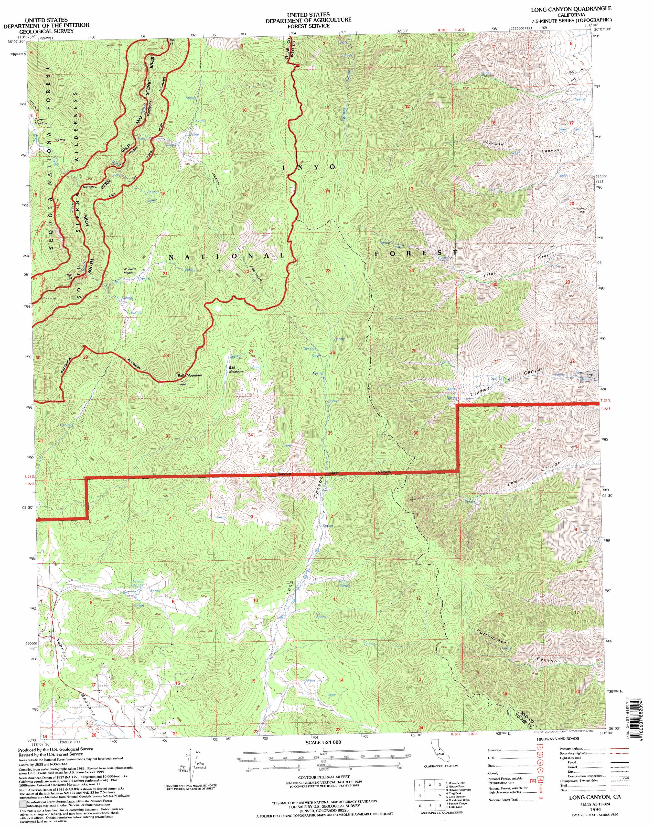
USGS Topo Quad 36118a1 - 1:24,000 scale
| Topo Map Name: | Long Canyon |
| USGS Topo Quad ID: | 36118a1 |
| Print Size: | ca. 21 1/4" wide x 27" high |
| Southeast Coordinates: | 36° N latitude / 118° W longitude |
| Map Center Coordinates: | 36.0625° N latitude / 118.0625° W longitude |
| U.S. State: | CA |
| Filename: | o36118a1.jpg |
| Download Map JPG Image: | Long Canyon topo map 1:24,000 scale |
| Map Type: | Topographic |
| Topo Series: | 7.5´ |
| Map Scale: | 1:24,000 |
| Source of Map Images: | United States Geological Survey (USGS) |
| Alternate Map Versions: |
Long Canyon CA 1987, updated 1987 Download PDF Buy paper map Long Canyon CA 1987, updated 1994 Download PDF Buy paper map Long Canyon CA 1994, updated 1997 Download PDF Buy paper map Long Canyon CA 2012 Download PDF Buy paper map Long Canyon CA 2015 Download PDF Buy paper map |
| FStopo: | US Forest Service topo Long Canyon is available: Download FStopo PDF Download FStopo TIF |
1:24,000 Topo Quads surrounding Long Canyon
Kern Peak |
Templeton Mountain |
Olancha |
Vermillion Canyon |
Centennial Canyon |
Casa Vieja Meadows |
Monache Mountain |
Haiwee Pass |
Haiwee Reservoirs |
Upper Centennial Flat |
Bonita Meadows |
Crag Peak |
Long Canyon |
Coso Junction |
Cactus Peak |
Sirretta Peak |
Rockhouse Basin |
Sacatar Canyon |
Little Lake |
Volcano Peak |
Cannell Peak |
White Dome |
Lamont Peak |
Ninemile Canyon |
Pearsonville |
> Back to 36118a1 at 1:100,000 scale
> Back to 36118a1 at 1:250,000 scale
> Back to U.S. Topo Maps home
Long Canyon topo map: Gazetteer
Long Canyon: Airports
Porter Ranch Airport elevation 2015m 6610′Long Canyon: Flats
Ball Meadow elevation 2609m 8559′Wildrose Meadows elevation 2205m 7234′
Long Canyon: Springs
Willow Spring elevation 2180m 7152′Windy Springs elevation 1976m 6482′
Long Canyon: Streams
Crag Creek elevation 2040m 6692′Long Canyon: Summits
Ball Mountain elevation 2822m 9258′Long Canyon digital topo map on disk
Buy this Long Canyon topo map showing relief, roads, GPS coordinates and other geographical features, as a high-resolution digital map file on DVD:
Southern Sierra Nevada, California & Southern Nevada
Buy digital topo maps: Southern Sierra Nevada, California & Southern Nevada