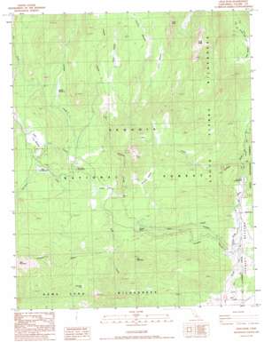
Crag Peak Topo Map California
To zoom in, hover over the map of Crag Peak
USGS Topo Quad 36118a2 - 1:24,000 scale
| Topo Map Name: | Crag Peak |
| USGS Topo Quad ID: | 36118a2 |
| Print Size: | ca. 21 1/4" wide x 27" high |
| Southeast Coordinates: | 36° N latitude / 118.125° W longitude |
| Map Center Coordinates: | 36.0625° N latitude / 118.1875° W longitude |
| U.S. State: | CA |
| Filename: | o36118a2.jpg |
| Download Map JPG Image: | Crag Peak topo map 1:24,000 scale |
| Map Type: | Topographic |
| Topo Series: | 7.5´ |
| Map Scale: | 1:24,000 |
| Source of Map Images: | United States Geological Survey (USGS) |
| Alternate Map Versions: |
Crag Peak CA 1987, updated 1987 Download PDF Buy paper map Crag Peak CA 1987, updated 1994 Download PDF Buy paper map Crag Peak CA 2012 Download PDF Buy paper map Crag Peak CA 2015 Download PDF Buy paper map |
| FStopo: | US Forest Service topo Crag Peak is available: Download FStopo PDF Download FStopo TIF |
1:24,000 Topo Quads surrounding Crag Peak
> Back to 36118a1 at 1:100,000 scale
> Back to 36118a1 at 1:250,000 scale
> Back to U.S. Topo Maps home
Crag Peak topo map: Gazetteer
Crag Peak: Benches
Tussock Bench elevation 2142m 7027′Crag Peak: Flats
Clover Meadow elevation 2183m 7162′Corral Meadow elevation 2581m 8467′
Dead Horse Meadow elevation 2230m 7316′
Hooker Meadow elevation 2541m 8336′
Jackass Meadows elevation 2362m 7749′
Kennedy Meadows elevation 1891m 6204′
Little Troy Meadow elevation 2352m 7716′
Rodeo Flat elevation 2228m 7309′
Troy Meadow elevation 2350m 7709′
Crag Peak: Gaps
Bakeoven Pass elevation 2242m 7355′Crag Peak: Pillars
Finger Rock elevation 2704m 8871′Crag Peak: Streams
Bitter Creek elevation 1839m 6033′Jackass Creek elevation 2254m 7395′
Lost Creek elevation 1870m 6135′
Mahogany Creek elevation 2222m 7290′
Crag Peak: Summits
Crag Peak elevation 2877m 9438′Pine Mountain elevation 2484m 8149′
Crag Peak digital topo map on disk
Buy this Crag Peak topo map showing relief, roads, GPS coordinates and other geographical features, as a high-resolution digital map file on DVD:
Southern Sierra Nevada, California & Southern Nevada
Buy digital topo maps: Southern Sierra Nevada, California & Southern Nevada


