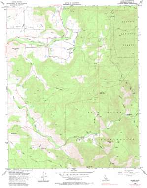
Globe Topo Map California
To zoom in, hover over the map of Globe
USGS Topo Quad 36118a7 - 1:24,000 scale
| Topo Map Name: | Globe |
| USGS Topo Quad ID: | 36118a7 |
| Print Size: | ca. 21 1/4" wide x 27" high |
| Southeast Coordinates: | 36° N latitude / 118.75° W longitude |
| Map Center Coordinates: | 36.0625° N latitude / 118.8125° W longitude |
| U.S. State: | CA |
| Filename: | o36118a7.jpg |
| Download Map JPG Image: | Globe topo map 1:24,000 scale |
| Map Type: | Topographic |
| Topo Series: | 7.5´ |
| Map Scale: | 1:24,000 |
| Source of Map Images: | United States Geological Survey (USGS) |
| Alternate Map Versions: |
Globe CA 1956, updated 1957 Download PDF Buy paper map Globe CA 1956, updated 1963 Download PDF Buy paper map Globe CA 1956, updated 1985 Download PDF Buy paper map Globe CA 2012 Download PDF Buy paper map Globe CA 2015 Download PDF Buy paper map |
| FStopo: | US Forest Service topo Globe is available: Download FStopo PDF Download FStopo TIF |
1:24,000 Topo Quads surrounding Globe
> Back to 36118a1 at 1:100,000 scale
> Back to 36118a1 at 1:250,000 scale
> Back to U.S. Topo Maps home
Globe topo map: Gazetteer
Globe: Basins
Pleasant Valley elevation 233m 764′Globe: Canals
Graham-Osborn Ditch elevation 283m 928′Moore-Witt Ditch elevation 256m 839′
Pleasant Valley Ditch elevation 281m 921′
South Tule Ditch elevation 250m 820′
Globe: Dams
Larson 712 Dam elevation 246m 807′Globe: Flats
Joaquin Flat elevation 863m 2831′Oak Flat elevation 705m 2312′
Globe: Populated Places
Globe elevation 253m 830′Soda Springs elevation 430m 1410′
Globe: Springs
Ward Spring elevation 617m 2024′Globe: Streams
Blue Creek elevation 405m 1328′Bond Creek elevation 428m 1404′
Campbell Creek elevation 210m 688′
Cow Mountain Creek elevation 340m 1115′
Crew Creek elevation 221m 725′
Gibbon Creek elevation 321m 1053′
Graham Creek elevation 244m 800′
Long Branch elevation 248m 813′
Rocky Creek elevation 427m 1400′
Globe: Summits
Bagby Hill elevation 469m 1538′Big Campbell elevation 410m 1345′
Bonsall Hill elevation 504m 1653′
Cow Mountain elevation 1149m 3769′
Oak Flat Peak elevation 830m 2723′
Oat Mountain elevation 1063m 3487′
Snail Head elevation 576m 1889′
Globe: Valleys
Blue Canyon elevation 591m 1938′Duncan Canyon elevation 402m 1318′
Gibbon Canyon elevation 328m 1076′
Street Canyon elevation 480m 1574′
Globe digital topo map on disk
Buy this Globe topo map showing relief, roads, GPS coordinates and other geographical features, as a high-resolution digital map file on DVD:
Southern Sierra Nevada, California & Southern Nevada
Buy digital topo maps: Southern Sierra Nevada, California & Southern Nevada


