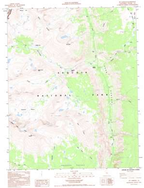
Mount Kaweah Topo Map California
To zoom in, hover over the map of Mount Kaweah
USGS Topo Quad 36118e4 - 1:24,000 scale
| Topo Map Name: | Mount Kaweah |
| USGS Topo Quad ID: | 36118e4 |
| Print Size: | ca. 21 1/4" wide x 27" high |
| Southeast Coordinates: | 36.5° N latitude / 118.375° W longitude |
| Map Center Coordinates: | 36.5625° N latitude / 118.4375° W longitude |
| U.S. State: | CA |
| Filename: | o36118e4.jpg |
| Download Map JPG Image: | Mount Kaweah topo map 1:24,000 scale |
| Map Type: | Topographic |
| Topo Series: | 7.5´ |
| Map Scale: | 1:24,000 |
| Source of Map Images: | United States Geological Survey (USGS) |
| Alternate Map Versions: |
Mt. Kaweah CA 1985, updated 1985 Download PDF Buy paper map Mt. Kaweah CA 1985, updated 1985 Download PDF Buy paper map Mt. Kaweah CA 1993, updated 1994 Download PDF Buy paper map Mount Kaweah CA 2012 Download PDF Buy paper map Mount Kaweah CA 2015 Download PDF Buy paper map |
1:24,000 Topo Quads surrounding Mount Kaweah
> Back to 36118e1 at 1:100,000 scale
> Back to 36118a1 at 1:250,000 scale
> Back to U.S. Topo Maps home
Mount Kaweah topo map: Gazetteer
Mount Kaweah: Basins
Kaweah Basin elevation 3439m 11282′Milestone Bowl elevation 3586m 11765′
Mount Kaweah: Flats
Junction Meadow elevation 2461m 8074′Mount Kaweah: Lakes
Gallats Lake elevation 3056m 10026′Rockslide Lake elevation 2762m 9061′
Mount Kaweah: Plains
Bighorn Plateau elevation 3476m 11404′Mount Kaweah: Ridges
Great Western Divide elevation 4174m 13694′Kaweah Peaks Ridge elevation 4205m 13795′
Red Spur elevation 3833m 12575′
Mount Kaweah: Streams
Kern-Kaweah River elevation 2472m 8110′Picket Creek elevation 2769m 9084′
Tyndall Creek elevation 2762m 9061′
Wallace Creek elevation 2457m 8061′
Whitney Creek elevation 2388m 7834′
Wright Creek elevation 3020m 9908′
Mount Kaweah: Summits
Kern Point elevation 3891m 12765′Mount Kaweah elevation 4205m 13795′
Picket Guard Peak elevation 3732m 12244′
Mount Kaweah digital topo map on disk
Buy this Mount Kaweah topo map showing relief, roads, GPS coordinates and other geographical features, as a high-resolution digital map file on DVD:
Southern Sierra Nevada, California & Southern Nevada
Buy digital topo maps: Southern Sierra Nevada, California & Southern Nevada


