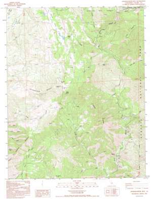
Shadequarter Mountain Topo Map California
To zoom in, hover over the map of Shadequarter Mountain
USGS Topo Quad 36118e8 - 1:24,000 scale
| Topo Map Name: | Shadequarter Mountain |
| USGS Topo Quad ID: | 36118e8 |
| Print Size: | ca. 21 1/4" wide x 27" high |
| Southeast Coordinates: | 36.5° N latitude / 118.875° W longitude |
| Map Center Coordinates: | 36.5625° N latitude / 118.9375° W longitude |
| U.S. State: | CA |
| Filename: | o36118e8.jpg |
| Download Map JPG Image: | Shadequarter Mountain topo map 1:24,000 scale |
| Map Type: | Topographic |
| Topo Series: | 7.5´ |
| Map Scale: | 1:24,000 |
| Source of Map Images: | United States Geological Survey (USGS) |
| Alternate Map Versions: |
Shadequarter Mtn CA 1987, updated 1987 Download PDF Buy paper map Shadequarter Mtn CA 1993, updated 1995 Download PDF Buy paper map Shadequarter Mountain CA 2012 Download PDF Buy paper map Shadequarter Mountain CA 2015 Download PDF Buy paper map |
| FStopo: | US Forest Service topo Shadequarter Mountain is available: Download FStopo PDF Download FStopo TIF |
1:24,000 Topo Quads surrounding Shadequarter Mountain
> Back to 36118e1 at 1:100,000 scale
> Back to 36118a1 at 1:250,000 scale
> Back to U.S. Topo Maps home
Shadequarter Mountain topo map: Gazetteer
Shadequarter Mountain: Basins
Tarbell Pocket elevation 951m 3120′Shadequarter Mountain: Flats
Dry Valley elevation 823m 2700′Shadequarter Mountain: Gaps
Live Oak Pass elevation 1245m 4084′Shadequarter Mountain: Pillars
Pattee Rocks elevation 1290m 4232′Shadequarter Mountain: Populated Places
Advance elevation 412m 1351′Shadequarter Mountain: Ridges
Becketts Backbone elevation 824m 2703′Sheep Ridge elevation 1122m 3681′
Shadequarter Mountain: Streams
Bear Creek elevation 358m 1174′Burnt Point Creek elevation 647m 2122′
Eshom Creek elevation 726m 2381′
Pierce Creek elevation 786m 2578′
Redwood Creek elevation 1124m 3687′
Sheep Creek elevation 355m 1164′
Yucca Creek elevation 525m 1722′
Shadequarter Mountain: Summits
Burnt Point elevation 1132m 3713′Shadequarter Mountain elevation 1214m 3982′
Shadequarter Mountain: Valleys
Eshom Valley elevation 1021m 3349′Live Oak Gulch elevation 717m 2352′
Shadequarter Mountain digital topo map on disk
Buy this Shadequarter Mountain topo map showing relief, roads, GPS coordinates and other geographical features, as a high-resolution digital map file on DVD:
Southern Sierra Nevada, California & Southern Nevada
Buy digital topo maps: Southern Sierra Nevada, California & Southern Nevada


