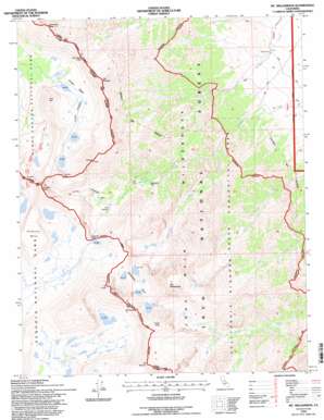
Mount Williamson Topo Map California
To zoom in, hover over the map of Mount Williamson
USGS Topo Quad 36118f3 - 1:24,000 scale
| Topo Map Name: | Mount Williamson |
| USGS Topo Quad ID: | 36118f3 |
| Print Size: | ca. 21 1/4" wide x 27" high |
| Southeast Coordinates: | 36.625° N latitude / 118.25° W longitude |
| Map Center Coordinates: | 36.6875° N latitude / 118.3125° W longitude |
| U.S. State: | CA |
| Filename: | o36118f3.jpg |
| Download Map JPG Image: | Mount Williamson topo map 1:24,000 scale |
| Map Type: | Topographic |
| Topo Series: | 7.5´ |
| Map Scale: | 1:24,000 |
| Source of Map Images: | United States Geological Survey (USGS) |
| Alternate Map Versions: |
Mt. Williamson CA 1984, updated 1985 Download PDF Buy paper map Mt. Williamson CA 1993, updated 1994 Download PDF Buy paper map Mt. Williamson CA 1994, updated 1997 Download PDF Buy paper map Mount Williamson CA 2012 Download PDF Buy paper map Mount Williamson CA 2015 Download PDF Buy paper map |
| FStopo: | US Forest Service topo Mount Williamson is available: Download FStopo PDF Download FStopo TIF |
1:24,000 Topo Quads surrounding Mount Williamson
> Back to 36118e1 at 1:100,000 scale
> Back to 36118a1 at 1:250,000 scale
> Back to U.S. Topo Maps home
Mount Williamson topo map: Gazetteer
Mount Williamson: Basins
Center Basin elevation 3417m 11210′The Pothole elevation 3298m 10820′
Williamson Bowl elevation 3599m 11807′
Mount Williamson: Benches
Diamond Mesa elevation 3902m 12801′Mount Williamson: Flats
Mahogany Flat elevation 2829m 9281′Mount Williamson: Gaps
Forester Pass elevation 4009m 13152′Junction Pass elevation 4004m 13136′
Shepherd Pass elevation 3666m 12027′
Mount Williamson: Lakes
Golden Bear Lake elevation 3407m 11177′Lake Helen of Troy elevation 3818m 12526′
Wright Lakes elevation 3400m 11154′
Mount Williamson: Pillars
Center Basin Crags elevation 3713m 12181′Mount Williamson: Streams
Williamson Creek elevation 2189m 7181′Mount Williamson: Summits
Center Peak elevation 3860m 12664′Junction Peak elevation 4224m 13858′
Mount Barnard elevation 4234m 13891′
Mount Bradley elevation 4018m 13182′
Mount Keith elevation 4249m 13940′
Mount Tyndall elevation 4259m 13973′
Mount Versteeg elevation 4022m 13195′
Mount Williamson elevation 4384m 14383′
Trojan Peak elevation 4221m 13848′
University Peak elevation 4105m 13467′
Mount Williamson digital topo map on disk
Buy this Mount Williamson topo map showing relief, roads, GPS coordinates and other geographical features, as a high-resolution digital map file on DVD:
Southern Sierra Nevada, California & Southern Nevada
Buy digital topo maps: Southern Sierra Nevada, California & Southern Nevada


