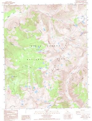
Marion Peak Topo Map California
To zoom in, hover over the map of Marion Peak
USGS Topo Quad 36118h5 - 1:24,000 scale
| Topo Map Name: | Marion Peak |
| USGS Topo Quad ID: | 36118h5 |
| Print Size: | ca. 21 1/4" wide x 27" high |
| Southeast Coordinates: | 36.875° N latitude / 118.5° W longitude |
| Map Center Coordinates: | 36.9375° N latitude / 118.5625° W longitude |
| U.S. State: | CA |
| Filename: | o36118h5.jpg |
| Download Map JPG Image: | Marion Peak topo map 1:24,000 scale |
| Map Type: | Topographic |
| Topo Series: | 7.5´ |
| Map Scale: | 1:24,000 |
| Source of Map Images: | United States Geological Survey (USGS) |
| Alternate Map Versions: |
Marion Peak CA 1988, updated 1988 Download PDF Buy paper map Marion Peak CA 1988, updated 1995 Download PDF Buy paper map Marion Peak CA 2012 Download PDF Buy paper map Marion Peak CA 2015 Download PDF Buy paper map |
1:24,000 Topo Quads surrounding Marion Peak
> Back to 36118e1 at 1:100,000 scale
> Back to 36118a1 at 1:250,000 scale
> Back to U.S. Topo Maps home
Marion Peak topo map: Gazetteer
Marion Peak: Basins
Lake Basin elevation 3233m 10606′Marion Peak: Capes
Red Point elevation 3432m 11259′Marion Peak: Cliffs
Muro Blanco elevation 3000m 9842′Marion Peak: Falls
Triple Falls elevation 2505m 8218′Marion Peak: Flats
Dougherty Meadow elevation 2945m 9662′Horseshoe Meadows elevation 3147m 10324′
Marion Peak: Gaps
Granite Pass elevation 3255m 10679′Marion Peak: Lakes
Glacier Lakes elevation 3180m 10433′Horseshoe Lakes elevation 3207m 10521′
Kid Lakes elevation 3168m 10393′
Lake of the Fallen Moon elevation 2728m 8950′
Marion Lake elevation 3140m 10301′
State Lakes elevation 3193m 10475′
Marion Peak: Parks
Kings Canyon National Park elevation 2808m 9212′Marion Peak: Post Offices
Kings Canyon National Park Post Office (historical) elevation 2714m 8904′Marion Peak: Ridges
Arrow Ridge elevation 3644m 11955′Cirque Crest elevation 3820m 12532′
Goat Crest elevation 3583m 11755′
Windy Ridge elevation 3447m 11309′
Marion Peak: Streams
Cartridge Creek elevation 1937m 6354′East Fork Dougherty Creek elevation 2360m 7742′
Goddard Creek elevation 1818m 5964′
Kid Creek elevation 2368m 7769′
Middle Fork Dougherty Creek elevation 2407m 7896′
North Fork Kid Creek elevation 2655m 8710′
South Fork Cartridge Creek elevation 2476m 8123′
West Fork Dougherty Creek elevation 2360m 7742′
Marion Peak: Summits
Dougherty Peak elevation 3720m 12204′Kid Peak elevation 3477m 11407′
Marion Peak elevation 3832m 12572′
State Peak elevation 3840m 12598′
Windy Peak elevation 2688m 8818′
Marion Peak: Valleys
Glacier Valley elevation 2994m 9822′Windy Canyon elevation 1894m 6213′
Marion Peak digital topo map on disk
Buy this Marion Peak topo map showing relief, roads, GPS coordinates and other geographical features, as a high-resolution digital map file on DVD:
Southern Sierra Nevada, California & Southern Nevada
Buy digital topo maps: Southern Sierra Nevada, California & Southern Nevada


