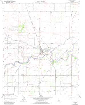
Laton Topo Map California
To zoom in, hover over the map of Laton
USGS Topo Quad 36119d6 - 1:24,000 scale
| Topo Map Name: | Laton |
| USGS Topo Quad ID: | 36119d6 |
| Print Size: | ca. 21 1/4" wide x 27" high |
| Southeast Coordinates: | 36.375° N latitude / 119.625° W longitude |
| Map Center Coordinates: | 36.4375° N latitude / 119.6875° W longitude |
| U.S. State: | CA |
| Filename: | o36119d6.jpg |
| Download Map JPG Image: | Laton topo map 1:24,000 scale |
| Map Type: | Topographic |
| Topo Series: | 7.5´ |
| Map Scale: | 1:24,000 |
| Source of Map Images: | United States Geological Survey (USGS) |
| Alternate Map Versions: |
Laton CA 1953, updated 1957 Download PDF Buy paper map Laton CA 1953, updated 1968 Download PDF Buy paper map Laton CA 1953, updated 1988 Download PDF Buy paper map Laton CA 2012 Download PDF Buy paper map Laton CA 2015 Download PDF Buy paper map |
1:24,000 Topo Quads surrounding Laton
> Back to 36119a1 at 1:100,000 scale
> Back to 36118a1 at 1:250,000 scale
> Back to U.S. Topo Maps home
Laton topo map: Gazetteer
Laton: Canals
Crossout Waste elevation 81m 265′Dutch John Cut elevation 80m 262′
Peoples Ditch elevation 80m 262′
Laton: Crossings
Whitmores Ferry (historical) elevation 76m 249′Laton: Dams
Last Chance Weir 723 elevation 79m 259′Lemoore Diversion Weir 722 elevation 76m 249′
Reynolds Weir 80 elevation 78m 255′
Laton: Parks
Kingston Historical Marker elevation 77m 252′Laton-Kingston Park elevation 76m 249′
Mussel Slough Tragedy Historical Marker elevation 75m 246′
Laton: Populated Places
Hardwick elevation 76m 249′Hasset (historical) elevation 75m 246′
Kingston (historical) elevation 77m 252′
Laton elevation 79m 259′
Lillis (historical) elevation 77m 252′
Lucerne elevation 79m 259′
Shirley elevation 79m 259′
Laton: Post Offices
Laton Post Office elevation 78m 255′Laton: Streams
Cole Slough elevation 77m 252′Laton digital topo map on disk
Buy this Laton topo map showing relief, roads, GPS coordinates and other geographical features, as a high-resolution digital map file on DVD:
Southern Sierra Nevada, California & Southern Nevada
Buy digital topo maps: Southern Sierra Nevada, California & Southern Nevada


