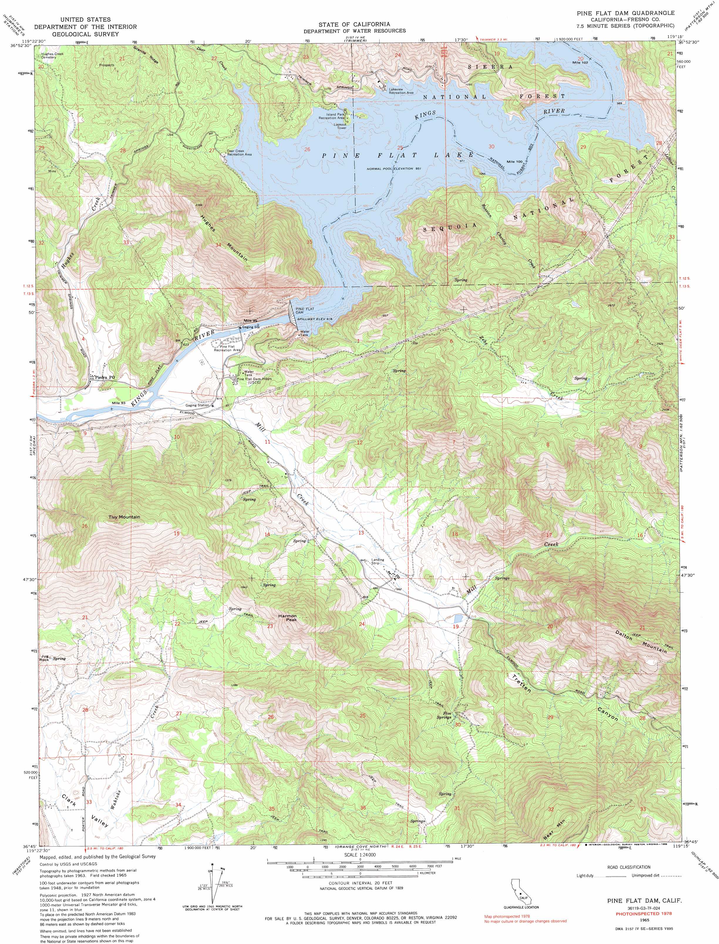
Pine Flat Dam Topo Map California
To zoom in, hover over the map of Pine Flat Dam
USGS Topo Quad 36119g3 - 1:24,000 scale
| Topo Map Name: | Pine Flat Dam |
| USGS Topo Quad ID: | 36119g3 |
| Print Size: | ca. 21 1/4" wide x 27" high |
| Southeast Coordinates: | 36.75° N latitude / 119.25° W longitude |
| Map Center Coordinates: | 36.8125° N latitude / 119.3125° W longitude |
| U.S. State: | CA |
| Filename: | o36119g3.jpg |
| Download Map JPG Image: | Pine Flat Dam topo map 1:24,000 scale |
| Map Type: | Topographic |
| Topo Series: | 7.5´ |
| Map Scale: | 1:24,000 |
| Source of Map Images: | United States Geological Survey (USGS) |
| Alternate Map Versions: |
Pine Flat Dam CA 1965, updated 1967 Download PDF Buy paper map Pine Flat Dam CA 1965, updated 1986 Download PDF Buy paper map Pine Flat Dam CA 1965, updated 1986 Download PDF Buy paper map Pine Flat Dam CA 2012 Download PDF Buy paper map Pine Flat Dam CA 2015 Download PDF Buy paper map |
| FStopo: | US Forest Service topo Pine Flat Dam is available: Download FStopo PDF Download FStopo TIF |
1:24,000 Topo Quads surrounding Pine Flat Dam
Millerton Lake East |
Auberry |
Shaver Lake |
Dinkey Creek |
Nelson Mountain |
Academy |
Humphreys Station |
Trimmer |
Sacate Ridge |
Patterson Mountain |
Round Mountain |
Piedra |
Pine Flat Dam |
Luckett Mountain |
Verplank Ridge |
Sanger |
Wahtoke |
Orange Cove North |
Tucker Mountain |
Miramonte |
Selma |
Reedley |
Orange Cove South |
Stokes Mountain |
Auckland |
> Back to 36119e1 at 1:100,000 scale
> Back to 36118a1 at 1:250,000 scale
> Back to U.S. Topo Maps home
Pine Flat Dam topo map: Gazetteer
Pine Flat Dam: Airports
Wonder Valley Airport elevation 203m 666′Pine Flat Dam: Basins
Clark Valley elevation 172m 564′Wonder Valley elevation 225m 738′
Pine Flat Dam: Dams
Pine Flat Dam elevation 261m 856′Pine Flat Dam: Flats
Pine Flat elevation 291m 954′Pine Flat Dam: Mines
Sunnyside Mine elevation 408m 1338′Pine Flat Dam: Pillars
Jug Rock elevation 269m 882′Pine Flat Dam: Post Offices
Piedra Post Office elevation 174m 570′Pine Flat Dam: Reservoirs
Pine Flat Lake elevation 261m 856′Pine Flat Dam: Springs
Five Springs elevation 315m 1033′Pine Flat Dam: Streams
Deer Creek elevation 291m 954′Lefever Creek elevation 291m 954′
Mill Creek elevation 166m 544′
Russian Charley Creek elevation 299m 980′
Zebe Creek elevation 293m 961′
Pine Flat Dam: Summits
Harmon Peak elevation 667m 2188′Hughes Mountain elevation 722m 2368′
Tivy Mountain elevation 865m 2837′
Pine Flat Dam: Valleys
Tretten Canyon elevation 208m 682′Pine Flat Dam digital topo map on disk
Buy this Pine Flat Dam topo map showing relief, roads, GPS coordinates and other geographical features, as a high-resolution digital map file on DVD:
Southern Sierra Nevada, California & Southern Nevada
Buy digital topo maps: Southern Sierra Nevada, California & Southern Nevada