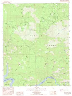
Sacate Ridge Topo Map California
To zoom in, hover over the map of Sacate Ridge
USGS Topo Quad 36119h2 - 1:24,000 scale
| Topo Map Name: | Sacate Ridge |
| USGS Topo Quad ID: | 36119h2 |
| Print Size: | ca. 21 1/4" wide x 27" high |
| Southeast Coordinates: | 36.875° N latitude / 119.125° W longitude |
| Map Center Coordinates: | 36.9375° N latitude / 119.1875° W longitude |
| U.S. State: | CA |
| Filename: | o36119h2.jpg |
| Download Map JPG Image: | Sacate Ridge topo map 1:24,000 scale |
| Map Type: | Topographic |
| Topo Series: | 7.5´ |
| Map Scale: | 1:24,000 |
| Source of Map Images: | United States Geological Survey (USGS) |
| Alternate Map Versions: |
Sacate Ridge CA 1987, updated 1987 Download PDF Buy paper map Sacate Ridge CA 1987, updated 1987 Download PDF Buy paper map Sacate Ridge CA 2004, updated 2007 Download PDF Buy paper map Sacate Ridge CA 2012 Download PDF Buy paper map Sacate Ridge CA 2015 Download PDF Buy paper map |
| FStopo: | US Forest Service topo Sacate Ridge is available: Download FStopo PDF Download FStopo TIF |
1:24,000 Topo Quads surrounding Sacate Ridge
> Back to 36119e1 at 1:100,000 scale
> Back to 36118a1 at 1:250,000 scale
> Back to U.S. Topo Maps home
Sacate Ridge topo map: Gazetteer
Sacate Ridge: Airports
Balch Camp Heliport elevation 517m 1696′Sacate Ridge: Basins
Haslett Basin elevation 650m 2132′Sacate Ridge: Crossings
Ross Crossing elevation 1303m 4274′Sacate Ridge: Flats
Fence Meadow elevation 1464m 4803′Kirch Flat elevation 299m 980′
Kirch Flat elevation 291m 954′
Oak Flat elevation 1378m 4520′
Sacate Ridge: Gaps
Nutmeg Saddle elevation 1467m 4812′Sacate Ridge: Ridges
Sacate Ridge elevation 1039m 3408′Sacate Ridge: Springs
Sycamore Springs elevation 857m 2811′Sacate Ridge: Streams
Bear Meadow Creek elevation 751m 2463′Bear Wallow Creek elevation 899m 2949′
Big Creek elevation 309m 1013′
Deep Creek elevation 345m 1131′
Lower Rancheria Creek elevation 291m 954′
Nutmeg Creek elevation 446m 1463′
Oak Flat Creek elevation 1036m 3398′
Redoak Creek elevation 291m 954′
Ross Creek elevation 326m 1069′
Ross Creek elevation 940m 3083′
Rush Creek elevation 484m 1587′
Sacate Creek elevation 292m 958′
Sycamore Springs Creek elevation 291m 954′
Sacate Ridge: Valleys
Blue Canyon elevation 536m 1758′Sacate Ridge digital topo map on disk
Buy this Sacate Ridge topo map showing relief, roads, GPS coordinates and other geographical features, as a high-resolution digital map file on DVD:
Southern Sierra Nevada, California & Southern Nevada
Buy digital topo maps: Southern Sierra Nevada, California & Southern Nevada


