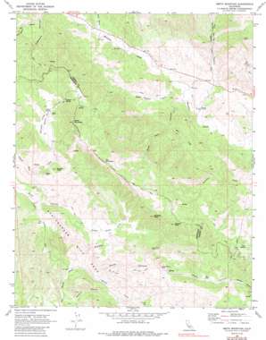
Smith Mountain Topo Map California
To zoom in, hover over the map of Smith Mountain
USGS Topo Quad 36120a5 - 1:24,000 scale
| Topo Map Name: | Smith Mountain |
| USGS Topo Quad ID: | 36120a5 |
| Print Size: | ca. 21 1/4" wide x 27" high |
| Southeast Coordinates: | 36° N latitude / 120.5° W longitude |
| Map Center Coordinates: | 36.0625° N latitude / 120.5625° W longitude |
| U.S. State: | CA |
| Filename: | o36120a5.jpg |
| Download Map JPG Image: | Smith Mountain topo map 1:24,000 scale |
| Map Type: | Topographic |
| Topo Series: | 7.5´ |
| Map Scale: | 1:24,000 |
| Source of Map Images: | United States Geological Survey (USGS) |
| Alternate Map Versions: |
Smith Mountain CA 1969, updated 1973 Download PDF Buy paper map Smith Mountain CA 1969, updated 1987 Download PDF Buy paper map Smith Mountain CA 2012 Download PDF Buy paper map Smith Mountain CA 2015 Download PDF Buy paper map |
1:24,000 Topo Quads surrounding Smith Mountain
> Back to 36120a1 at 1:100,000 scale
> Back to 36120a1 at 1:250,000 scale
> Back to U.S. Topo Maps home
Smith Mountain topo map: Gazetteer
Smith Mountain: Basins
Hidden Valley elevation 770m 2526′Smith Mountain: Mines
Stone Canyon Mine elevation 855m 2805′Smith Mountain: Pillars
The Pinnacles elevation 1147m 3763′Smith Mountain: Springs
Eric Spring elevation 910m 2985′Iron Spring elevation 949m 3113′
Quesada Spring elevation 963m 3159′
Sulphur Spring elevation 864m 2834′
Taylor Spring elevation 837m 2746′
Smith Mountain: Streams
Alum Creek elevation 485m 1591′Nelson Creek elevation 512m 1679′
Sulphur Creek elevation 436m 1430′
Wayland Creek elevation 512m 1679′
Smith Mountain: Summits
Andrews Peak elevation 1057m 3467′Eagle Rock elevation 850m 2788′
Eagle Rock elevation 836m 2742′
Frames Peak elevation 1087m 3566′
Smith Mountain elevation 1188m 3897′
Squaw Peak elevation 858m 2814′
Smith Mountain: Valleys
Bourdieu Valley elevation 799m 2621′Deep Well Canyon elevation 432m 1417′
Echo Canyon elevation 504m 1653′
Hog Canyon elevation 520m 1706′
Hot Springs Canyon elevation 424m 1391′
Salt Canyon elevation 554m 1817′
Sawmill Canyon elevation 896m 2939′
Stone Canyon elevation 534m 1751′
Sunk Canyon elevation 609m 1998′
Smith Mountain digital topo map on disk
Buy this Smith Mountain topo map showing relief, roads, GPS coordinates and other geographical features, as a high-resolution digital map file on DVD:


