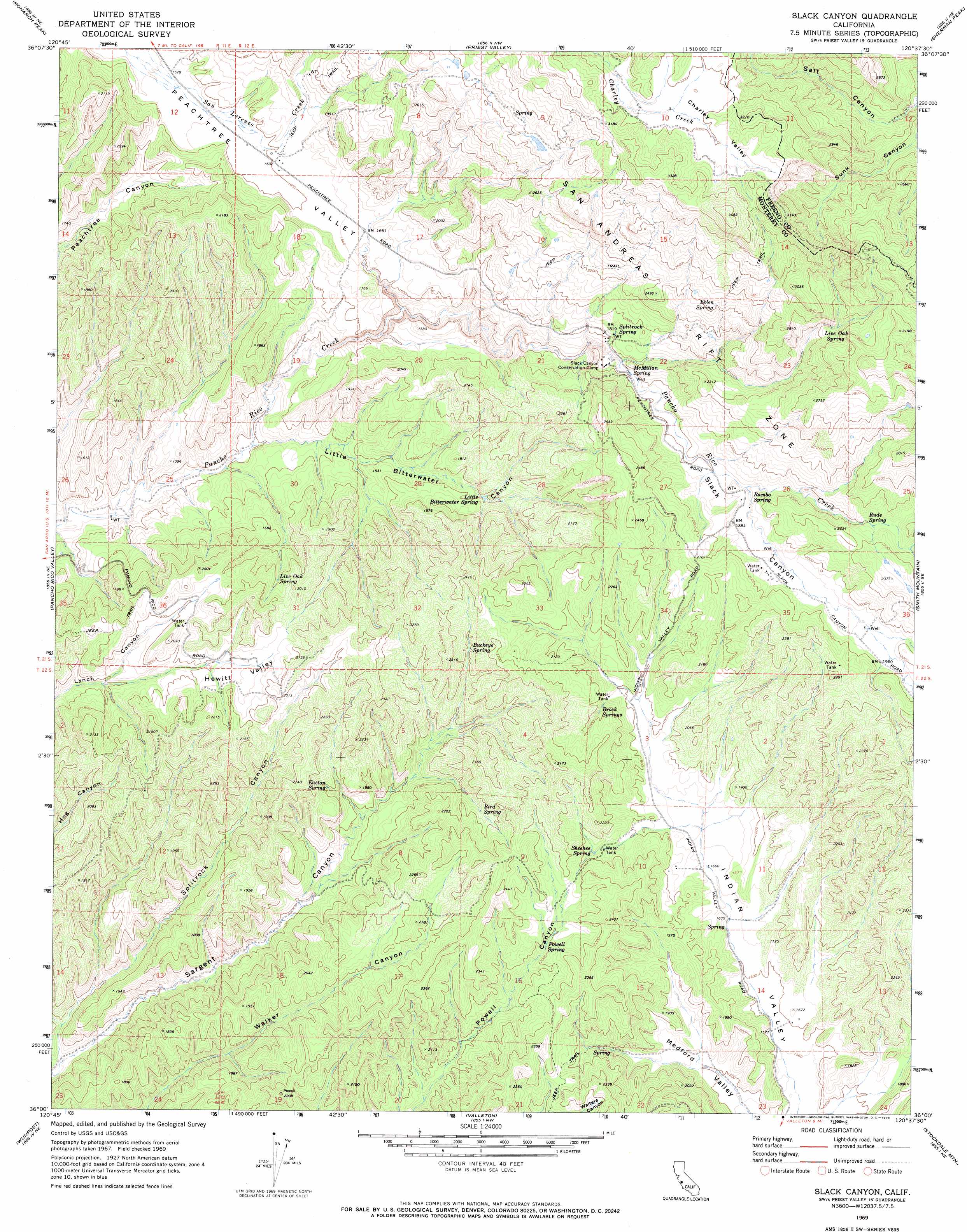
Slack Canyon Topo Map California
To zoom in, hover over the map of Slack Canyon
USGS Topo Quad 36120a6 - 1:24,000 scale
| Topo Map Name: | Slack Canyon |
| USGS Topo Quad ID: | 36120a6 |
| Print Size: | ca. 21 1/4" wide x 27" high |
| Southeast Coordinates: | 36° N latitude / 120.625° W longitude |
| Map Center Coordinates: | 36.0625° N latitude / 120.6875° W longitude |
| U.S. State: | CA |
| Filename: | o36120a6.jpg |
| Download Map JPG Image: | Slack Canyon topo map 1:24,000 scale |
| Map Type: | Topographic |
| Topo Series: | 7.5´ |
| Map Scale: | 1:24,000 |
| Source of Map Images: | United States Geological Survey (USGS) |
| Alternate Map Versions: |
Slack Canyon CA 1969, updated 1973 Download PDF Buy paper map Slack Canyon CA 1969, updated 1973 Download PDF Buy paper map Slack Canyon CA 2012 Download PDF Buy paper map Slack Canyon CA 2015 Download PDF Buy paper map |
1:24,000 Topo Quads surrounding Slack Canyon
Lonoak |
Hepsedam Peak |
San Benito Mountain |
Santa Rita Peak |
Joaquin Rocks |
Nattrass Valley |
Monarch Peak |
Priest Valley |
Sherman Peak |
Alcalde Hills |
San Ardo |
Pancho Rico Valley |
Slack Canyon |
Smith Mountain |
Curry Mountain |
Hames Valley |
Wunpost |
Valleton |
Stockdale Mountain |
Parkfield |
Tierra Redondo Mountain |
Bradley |
San Miguel |
Ranchito Canyon |
Cholame Hills |
> Back to 36120a1 at 1:100,000 scale
> Back to 36120a1 at 1:250,000 scale
> Back to U.S. Topo Maps home
Slack Canyon topo map: Gazetteer
Slack Canyon: Springs
Bird Spring elevation 600m 1968′Brock Springs elevation 592m 1942′
Buckeye Spring elevation 613m 2011′
Easton Spring elevation 535m 1755′
Eblen Spring elevation 747m 2450′
Little Bitterwater Spring elevation 483m 1584′
Live Oak Spring elevation 759m 2490′
Live Oak Spring elevation 547m 1794′
McMillan Spring elevation 533m 1748′
Powell Spring elevation 597m 1958′
Rambo Spring elevation 559m 1833′
Rude Spring elevation 613m 2011′
Sheehee Spring elevation 586m 1922′
Splitrock Spring elevation 567m 1860′
Slack Canyon: Valleys
Hewitt Valley elevation 478m 1568′Little Bitterwater Canyon elevation 367m 1204′
Slack Canyon elevation 422m 1384′
Splitrock Canyon elevation 346m 1135′
Slack Canyon digital topo map on disk
Buy this Slack Canyon topo map showing relief, roads, GPS coordinates and other geographical features, as a high-resolution digital map file on DVD: