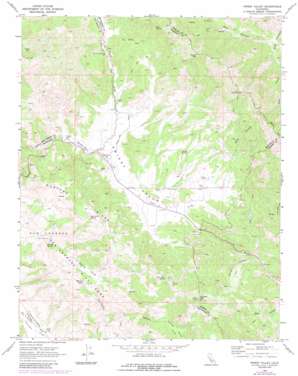
Priest Valley Topo Map California
To zoom in, hover over the map of Priest Valley
USGS Topo Quad 36120b6 - 1:24,000 scale
| Topo Map Name: | Priest Valley |
| USGS Topo Quad ID: | 36120b6 |
| Print Size: | ca. 21 1/4" wide x 27" high |
| Southeast Coordinates: | 36.125° N latitude / 120.625° W longitude |
| Map Center Coordinates: | 36.1875° N latitude / 120.6875° W longitude |
| U.S. State: | CA |
| Filename: | o36120b6.jpg |
| Download Map JPG Image: | Priest Valley topo map 1:24,000 scale |
| Map Type: | Topographic |
| Topo Series: | 7.5´ |
| Map Scale: | 1:24,000 |
| Source of Map Images: | United States Geological Survey (USGS) |
| Alternate Map Versions: |
Priest Valley CA 1969, updated 1973 Download PDF Buy paper map Priest Valley CA 1969, updated 1980 Download PDF Buy paper map Priest Valley CA 1969, updated 1984 Download PDF Buy paper map Priest Valley CA 2012 Download PDF Buy paper map Priest Valley CA 2015 Download PDF Buy paper map |
1:24,000 Topo Quads surrounding Priest Valley
> Back to 36120a1 at 1:100,000 scale
> Back to 36120a1 at 1:250,000 scale
> Back to U.S. Topo Maps home
Priest Valley topo map: Gazetteer
Priest Valley: Basins
Charley Valley elevation 945m 3100′Monroe Valley elevation 776m 2545′
Priest Valley elevation 689m 2260′
Priest Valley: Flats
Pretty Flat elevation 772m 2532′Priest Valley: Lakes
Monroe Lake elevation 778m 2552′Priest Valley: Springs
Bear Spring elevation 958m 3143′Bear Trap Spring elevation 988m 3241′
Buckeye Spring elevation 661m 2168′
Indian Spring elevation 757m 2483′
Log Cabin Spring elevation 968m 3175′
Priest Valley: Streams
Charley Creek elevation 568m 1863′North Fork Lewis Creek elevation 669m 2194′
Priest Valley: Summits
Charley Mountain elevation 1180m 3871′Charley Mountain elevation 1181m 3874′
Round Mountain elevation 1157m 3795′
Twin Peaks elevation 1298m 4258′
Priest Valley: Valleys
Bear Canyon elevation 607m 1991′Blue Canyon elevation 772m 2532′
Little Bear Canyon elevation 631m 2070′
Mulch Canyon elevation 605m 1984′
Priest Valley digital topo map on disk
Buy this Priest Valley topo map showing relief, roads, GPS coordinates and other geographical features, as a high-resolution digital map file on DVD:


