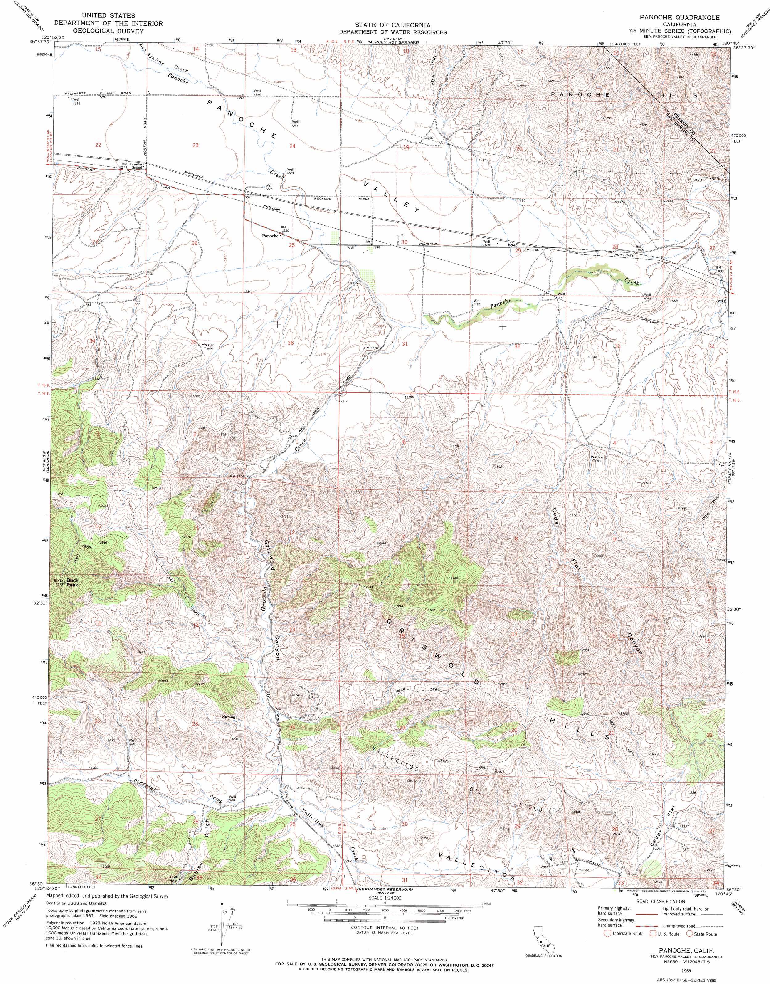
Panoche Topo Map California
To zoom in, hover over the map of Panoche
USGS Topo Quad 36120e7 - 1:24,000 scale
| Topo Map Name: | Panoche |
| USGS Topo Quad ID: | 36120e7 |
| Print Size: | ca. 21 1/4" wide x 27" high |
| Southeast Coordinates: | 36.5° N latitude / 120.75° W longitude |
| Map Center Coordinates: | 36.5625° N latitude / 120.8125° W longitude |
| U.S. State: | CA |
| Filename: | o36120e7.jpg |
| Download Map JPG Image: | Panoche topo map 1:24,000 scale |
| Map Type: | Topographic |
| Topo Series: | 7.5´ |
| Map Scale: | 1:24,000 |
| Source of Map Images: | United States Geological Survey (USGS) |
| Alternate Map Versions: |
Panoche CA 1969, updated 1972 Download PDF Buy paper map Panoche CA 1969, updated 1972 Download PDF Buy paper map Panoche CA 2012 Download PDF Buy paper map Panoche CA 2015 Download PDF Buy paper map |
1:24,000 Topo Quads surrounding Panoche
Ruby Canyon |
Ortigalita Peak |
Laguna Seca Ranch |
Hammonds Ranch |
Broadview Farms |
Panoche Pass |
Cerro Colorado |
Mercey Hot Springs |
Chounet Ranch |
Chaney Ranch |
San Benito |
Llanada |
Panoche |
Tumey Hills |
Monocline Ridge |
Topo Valley |
Rock Spring Peak |
Hernandez Reservoir |
Idria |
Ciervo Mountain |
Pinalito Canyon |
Lonoak |
Hepsedam Peak |
San Benito Mountain |
Santa Rita Peak |
> Back to 36120e1 at 1:100,000 scale
> Back to 36120a1 at 1:250,000 scale
> Back to U.S. Topo Maps home
Panoche topo map: Gazetteer
Panoche: Flats
Cedar Flat elevation 666m 2185′Panoche: Mines
Le Grant Mine elevation 411m 1348′Panoche: Populated Places
Panoche elevation 371m 1217′Panoche: Streams
Griswold Creek elevation 349m 1145′Las Aguilas Creek elevation 381m 1250′
Pimental Creek elevation 500m 1640′
Vallecitos Creek elevation 500m 1640′
Panoche: Summits
Buck Peak elevation 1075m 3526′Panoche: Valleys
Babies Gulch elevation 514m 1686′Cedar Flat Canyon elevation 342m 1122′
Griswold Canyon elevation 385m 1263′
Panoche Valley elevation 382m 1253′
Pimental Valley elevation 502m 1646′
Panoche digital topo map on disk
Buy this Panoche topo map showing relief, roads, GPS coordinates and other geographical features, as a high-resolution digital map file on DVD: