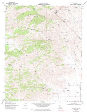
Cerro Colorado Topo Map California
To zoom in, hover over the map of Cerro Colorado
USGS Topo Quad 36120f8 - 1:24,000 scale
| Topo Map Name: | Cerro Colorado |
| USGS Topo Quad ID: | 36120f8 |
| Print Size: | ca. 21 1/4" wide x 27" high |
| Southeast Coordinates: | 36.625° N latitude / 120.875° W longitude |
| Map Center Coordinates: | 36.6875° N latitude / 120.9375° W longitude |
| U.S. State: | CA |
| Filename: | o36120f8.jpg |
| Download Map JPG Image: | Cerro Colorado topo map 1:24,000 scale |
| Map Type: | Topographic |
| Topo Series: | 7.5´ |
| Map Scale: | 1:24,000 |
| Source of Map Images: | United States Geological Survey (USGS) |
| Alternate Map Versions: |
Cerro Colorado CA 1969, updated 1972 Download PDF Buy paper map Cerro Colorado CA 1969, updated 1972 Download PDF Buy paper map Cerro Colorado CA 1969, updated 1985 Download PDF Buy paper map Cerro Colorado CA 2000, updated 2002 Download PDF Buy paper map Cerro Colorado CA 2012 Download PDF Buy paper map Cerro Colorado CA 2015 Download PDF Buy paper map |
1:24,000 Topo Quads surrounding Cerro Colorado
> Back to 36120e1 at 1:100,000 scale
> Back to 36120a1 at 1:250,000 scale
> Back to U.S. Topo Maps home
Cerro Colorado topo map: Gazetteer
Cerro Colorado: Mines
Ely Ray Mine elevation 592m 1942′Lone Oak Mine elevation 564m 1850′
Lucky Strike Mine elevation 609m 1998′
Mercey Mine elevation 389m 1276′
Valley View Mine elevation 481m 1578′
Cerro Colorado: Streams
South Fork Mercy Creek elevation 654m 2145′Vasquez Creek elevation 303m 994′
Cerro Colorado: Summits
Cerro Colorado elevation 1112m 3648′Cerro Colorado: Valleys
Las Aguilas Canyon elevation 448m 1469′Cerro Colorado digital topo map on disk
Buy this Cerro Colorado topo map showing relief, roads, GPS coordinates and other geographical features, as a high-resolution digital map file on DVD:


