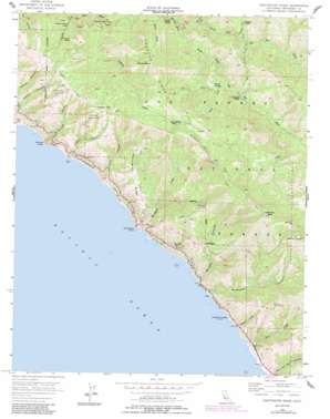
Partington Ridge Topo Map California
To zoom in, hover over the map of Partington Ridge
USGS Topo Quad 36121b6 - 1:24,000 scale
| Topo Map Name: | Partington Ridge |
| USGS Topo Quad ID: | 36121b6 |
| Print Size: | ca. 21 1/4" wide x 27" high |
| Southeast Coordinates: | 36.125° N latitude / 121.625° W longitude |
| Map Center Coordinates: | 36.1875° N latitude / 121.6875° W longitude |
| U.S. State: | CA |
| Filename: | o36121b6.jpg |
| Download Map JPG Image: | Partington Ridge topo map 1:24,000 scale |
| Map Type: | Topographic |
| Topo Series: | 7.5´ |
| Map Scale: | 1:24,000 |
| Source of Map Images: | United States Geological Survey (USGS) |
| Alternate Map Versions: |
Partington Ridge CA 1956, updated 1957 Download PDF Buy paper map Partington Ridge CA 1956, updated 1963 Download PDF Buy paper map Partington Ridge CA 1956, updated 1971 Download PDF Buy paper map Partington Ridge CA 1956, updated 1984 Download PDF Buy paper map Partington Ridge CA 1956, updated 1984 Download PDF Buy paper map Partington Ridge CA 1995, updated 2000 Download PDF Buy paper map Partington Ridge CA 2012 Download PDF Buy paper map Partington Ridge CA 2015 Download PDF Buy paper map |
| FStopo: | US Forest Service topo Partington Ridge is available: Download FStopo PDF Download FStopo TIF |
1:24,000 Topo Quads surrounding Partington Ridge
> Back to 36121a1 at 1:100,000 scale
> Back to 36120a1 at 1:250,000 scale
> Back to U.S. Topo Maps home
Partington Ridge topo map: Gazetteer
Partington Ridge: Bays
McWay Cove elevation 10m 32′Partington Cove elevation 0m 0′
Partington Ridge: Capes
Grimes Point elevation 107m 351′Partington Point elevation 19m 62′
Partington Ridge: Falls
McWay Falls elevation 5m 16′Partington Ridge: Islands
Lafler Rock elevation 0m 0′McWay Rocks elevation 1m 3′
Partington Ridge: Parks
Julia Pfeiffer Burns State Park elevation 435m 1427′Julia Pfeiffer Burns Underwater Area elevation -7m -23′
The California Sea Otter State Game Refuge elevation 108m 354′
Partington Ridge: Ridges
Logwood Ridge elevation 1099m 3605′Partington Ridge elevation 536m 1758′
Partington Ridge: Springs
Cold Spring elevation 1015m 3330′Partington Ridge: Streams
Anderson Creek elevation 4m 13′Buck Creek elevation 8m 26′
Burns Creek elevation 6m 19′
Cienega Creek elevation 486m 1594′
Logwood Creek elevation 258m 846′
McWay Creek elevation 1m 3′
Mocho Creek elevation 462m 1515′
North Fork Big Sur River elevation 350m 1148′
Partington Creek elevation 44m 144′
Pick Creek elevation 547m 1794′
Redwood Creek elevation 388m 1272′
South Fork Big Sur River elevation 350m 1148′
Terrace Creek elevation 238m 780′
Partington Ridge: Summits
Anderson Peak elevation 1249m 4097′Marble Peak elevation 1223m 4012′
Michaels Hill elevation 1144m 3753′
Mount Olmstead elevation 1094m 3589′
Saddle Rock elevation 15m 49′
Timber Top elevation 931m 3054′
Partington Ridge: Trails
Big Sur Trail elevation 563m 1847′Ewoldsen Trail elevation 518m 1699′
Overlook Trail elevation 5m 16′
Tan Bark Trail elevation 264m 866′
Waterfall Trail elevation 63m 206′
Partington Ridge: Valleys
Anderson Canyon elevation 33m 108′Grimes Canyon elevation 9m 29′
Lafler Canyon elevation 34m 111′
McWay Canyon elevation 38m 124′
Partington Canyon elevation 7m 22′
Torre Canyon elevation 24m 78′
Partington Ridge digital topo map on disk
Buy this Partington Ridge topo map showing relief, roads, GPS coordinates and other geographical features, as a high-resolution digital map file on DVD:


