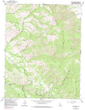
Rana Creek Topo Map California
To zoom in, hover over the map of Rana Creek
USGS Topo Quad 36121d5 - 1:24,000 scale
| Topo Map Name: | Rana Creek |
| USGS Topo Quad ID: | 36121d5 |
| Print Size: | ca. 21 1/4" wide x 27" high |
| Southeast Coordinates: | 36.375° N latitude / 121.5° W longitude |
| Map Center Coordinates: | 36.4375° N latitude / 121.5625° W longitude |
| U.S. State: | CA |
| Filename: | o36121d5.jpg |
| Download Map JPG Image: | Rana Creek topo map 1:24,000 scale |
| Map Type: | Topographic |
| Topo Series: | 7.5´ |
| Map Scale: | 1:24,000 |
| Source of Map Images: | United States Geological Survey (USGS) |
| Alternate Map Versions: |
Rana Creek CA 1956, updated 1958 Download PDF Buy paper map Rana Creek CA 1956, updated 1963 Download PDF Buy paper map Rana Creek CA 1956, updated 1977 Download PDF Buy paper map Rana Creek CA 1956, updated 1991 Download PDF Buy paper map Rana Creek CA 2012 Download PDF Buy paper map Rana Creek CA 2015 Download PDF Buy paper map |
1:24,000 Topo Quads surrounding Rana Creek
> Back to 36121a1 at 1:100,000 scale
> Back to 36120a1 at 1:250,000 scale
> Back to U.S. Topo Maps home
Rana Creek topo map: Gazetteer
Rana Creek: Streams
Big Creek elevation 476m 1561′Conejo Creek elevation 406m 1332′
Finch Creek elevation 406m 1332′
James Creek elevation 400m 1312′
Robertson Creek elevation 476m 1561′
Rana Creek: Summits
Buckeye Hill elevation 774m 2539′Burned Mountain elevation 863m 2831′
Haystack Hill elevation 638m 2093′
Red Hill elevation 753m 2470′
School Hill elevation 652m 2139′
Rana Creek: Valleys
Corral Viejo Canyon elevation 533m 1748′Madrona Canyon elevation 613m 2011′
Trampa Canyon elevation 327m 1072′
Rana Creek digital topo map on disk
Buy this Rana Creek topo map showing relief, roads, GPS coordinates and other geographical features, as a high-resolution digital map file on DVD:


