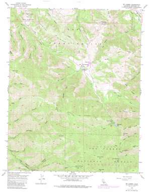
Mount Carmel Topo Map California
To zoom in, hover over the map of Mount Carmel
USGS Topo Quad 36121d7 - 1:24,000 scale
| Topo Map Name: | Mount Carmel |
| USGS Topo Quad ID: | 36121d7 |
| Print Size: | ca. 21 1/4" wide x 27" high |
| Southeast Coordinates: | 36.375° N latitude / 121.75° W longitude |
| Map Center Coordinates: | 36.4375° N latitude / 121.8125° W longitude |
| U.S. State: | CA |
| Filename: | o36121d7.jpg |
| Download Map JPG Image: | Mount Carmel topo map 1:24,000 scale |
| Map Type: | Topographic |
| Topo Series: | 7.5´ |
| Map Scale: | 1:24,000 |
| Source of Map Images: | United States Geological Survey (USGS) |
| Alternate Map Versions: |
Mt. Carmel CA 1956, updated 1963 Download PDF Buy paper map Mt. Carmel CA 1956, updated 1974 Download PDF Buy paper map Mt. Carmel CA 1956, updated 1984 Download PDF Buy paper map Mt. Carmel CA 1956, updated 1988 Download PDF Buy paper map Mount Carmel CA 1995, updated 2000 Download PDF Buy paper map Mount Carmel CA 2012 Download PDF Buy paper map Mount Carmel CA 2015 Download PDF Buy paper map |
| FStopo: | US Forest Service topo Mount Carmel is available: Download FStopo PDF Download FStopo TIF |
1:24,000 Topo Quads surrounding Mount Carmel
> Back to 36121a1 at 1:100,000 scale
> Back to 36120a1 at 1:250,000 scale
> Back to U.S. Topo Maps home
Mount Carmel topo map: Gazetteer
Mount Carmel: Dams
Black Rock Creek 643 Dam elevation 540m 1771′Mount Carmel: Flats
San Francisquito Flat elevation 428m 1404′Mount Carmel: Reservoirs
White Rock Lake elevation 540m 1771′Mount Carmel: Ridges
Black Rock Ridge elevation 838m 2749′Chamisal Ridge elevation 608m 1994′
Long Ridge elevation 503m 1650′
Long Ridge elevation 685m 2247′
San Clemente Ridge elevation 688m 2257′
White Rock Ridge elevation 1050m 3444′
Mount Carmel: Streams
Las Gazas Creek elevation 66m 216′Salsipuedes Creek elevation 450m 1476′
Mount Carmel: Summits
Devils Peak elevation 1261m 4137′Fish Head Hill elevation 772m 2532′
Mount Carmel elevation 1344m 4409′
Palo Corona elevation 899m 2949′
Pinyon Peak elevation 685m 2247′
Twin Peaks elevation 1088m 3569′
Vasquez Knob elevation 650m 2132′
Mount Carmel: Valleys
Van Winkleys Canyon elevation 247m 810′Williams Canyon elevation 271m 889′
Mount Carmel digital topo map on disk
Buy this Mount Carmel topo map showing relief, roads, GPS coordinates and other geographical features, as a high-resolution digital map file on DVD:


