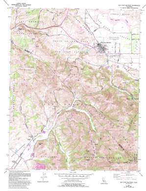
San Juan Bautista Topo Map California
To zoom in, hover over the map of San Juan Bautista
USGS Topo Quad 36121g5 - 1:24,000 scale
| Topo Map Name: | San Juan Bautista |
| USGS Topo Quad ID: | 36121g5 |
| Print Size: | ca. 21 1/4" wide x 27" high |
| Southeast Coordinates: | 36.75° N latitude / 121.5° W longitude |
| Map Center Coordinates: | 36.8125° N latitude / 121.5625° W longitude |
| U.S. State: | CA |
| Filename: | o36121g5.jpg |
| Download Map JPG Image: | San Juan Bautista topo map 1:24,000 scale |
| Map Type: | Topographic |
| Topo Series: | 7.5´ |
| Map Scale: | 1:24,000 |
| Source of Map Images: | United States Geological Survey (USGS) |
| Alternate Map Versions: |
San Juan Bautista CA 1955, updated 1956 Download PDF Buy paper map San Juan Bautista CA 1955, updated 1966 Download PDF Buy paper map San Juan Bautista CA 1955, updated 1970 Download PDF Buy paper map San Juan Bautista CA 1955, updated 1980 Download PDF Buy paper map San Juan Bautista CA 1955, updated 1994 Download PDF Buy paper map San Juan Bautista CA 1997, updated 2002 Download PDF Buy paper map San Juan Bautista CA 2012 Download PDF Buy paper map San Juan Bautista CA 2015 Download PDF Buy paper map |
1:24,000 Topo Quads surrounding San Juan Bautista
> Back to 36121e1 at 1:100,000 scale
> Back to 36120a1 at 1:250,000 scale
> Back to U.S. Topo Maps home
San Juan Bautista topo map: Gazetteer
San Juan Bautista: Areas
Popeloutchom elevation 59m 193′San Juan Bautista: Lakes
Lagunita Lake elevation 74m 242′San Juan Bautista: Parks
Abbe Park elevation 64m 209′Battle of Natividad State Historic Landmark elevation 70m 229′
Fremont Peak State Park elevation 851m 2791′
San Juan Bautista Historic District elevation 69m 226′
San Juan Bautista State Historic Park elevation 69m 226′
San Juan Bautista: Populated Places
Gabilan Acres elevation 62m 203′San Juan Bautista elevation 66m 216′
San Juan Bautista: Post Offices
San Juan Bautista Post Office elevation 65m 213′San Juan Bautista: Ridges
Cherry Tree Ridge elevation 498m 1633′Rocky Ridge elevation 853m 2798′
San Juan Bautista: Streams
Mud Creek elevation 87m 285′Towne Creek elevation 136m 446′
San Juan Bautista: Summits
Fremont Peak elevation 919m 3015′Pinecate Peak elevation 227m 744′
Sugarloaf Peak elevation 286m 938′
San Juan Bautista: Valleys
Crazy Horse Canyon elevation 77m 252′French Canyon elevation 162m 531′
Muertos Canyon elevation 76m 249′
Quinn Canyon elevation 191m 626′
San Juan Canyon elevation 84m 275′
San Juan Valley elevation 64m 209′
Vierra Canyon elevation 99m 324′
San Juan Bautista digital topo map on disk
Buy this San Juan Bautista topo map showing relief, roads, GPS coordinates and other geographical features, as a high-resolution digital map file on DVD:


