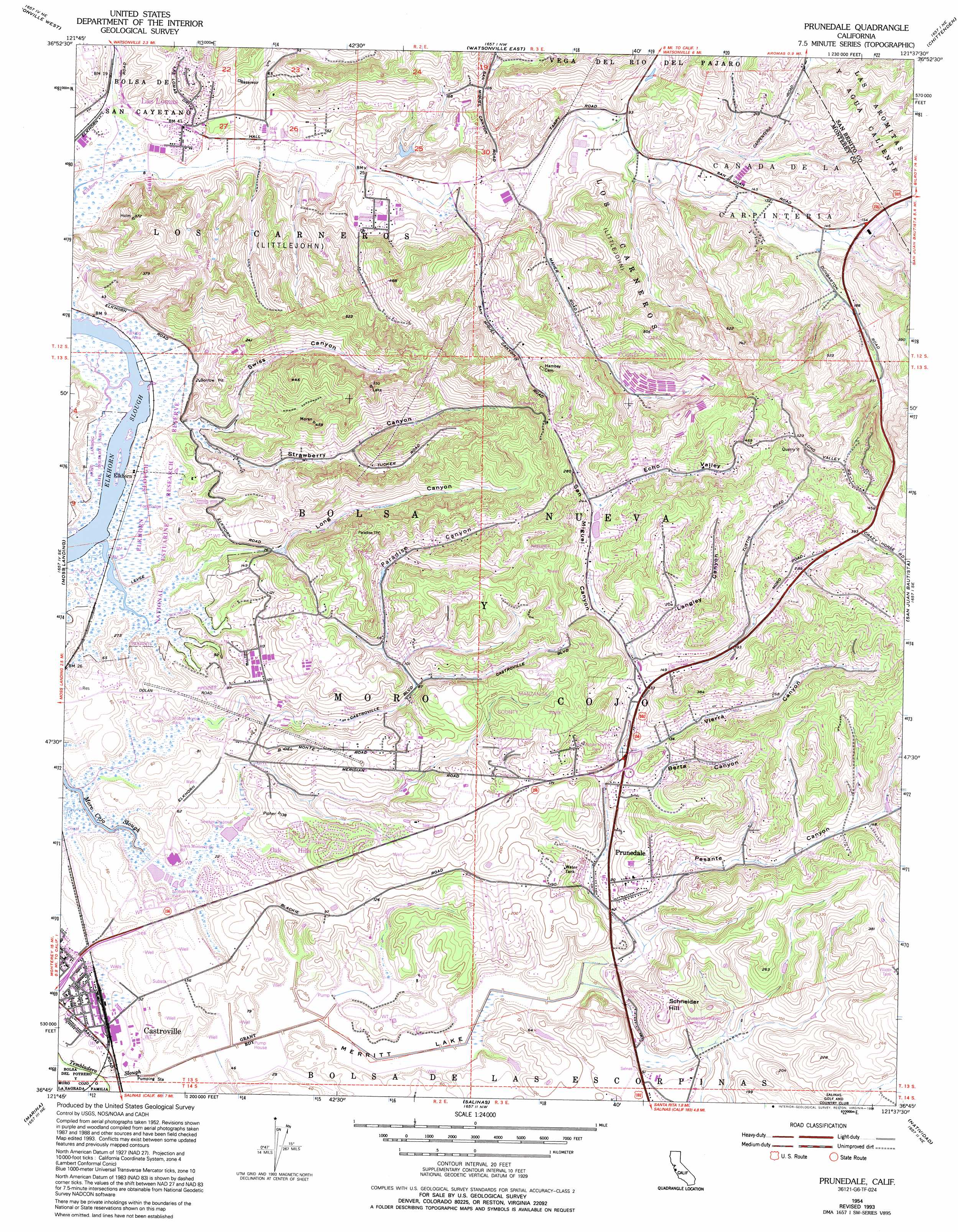
Prunedale Topo Map California
To zoom in, hover over the map of Prunedale
USGS Topo Quad 36121g6 - 1:24,000 scale
| Topo Map Name: | Prunedale |
| USGS Topo Quad ID: | 36121g6 |
| Print Size: | ca. 21 1/4" wide x 27" high |
| Southeast Coordinates: | 36.75° N latitude / 121.625° W longitude |
| Map Center Coordinates: | 36.8125° N latitude / 121.6875° W longitude |
| U.S. State: | CA |
| Filename: | o36121g6.jpg |
| Download Map JPG Image: | Prunedale topo map 1:24,000 scale |
| Map Type: | Topographic |
| Topo Series: | 7.5´ |
| Map Scale: | 1:24,000 |
| Source of Map Images: | United States Geological Survey (USGS) |
| Alternate Map Versions: |
Prunedale CA 1954, updated 1956 Download PDF Buy paper map Prunedale CA 1954, updated 1966 Download PDF Buy paper map Prunedale CA 1954, updated 1969 Download PDF Buy paper map Prunedale CA 1954, updated 1978 Download PDF Buy paper map Prunedale CA 1954, updated 1982 Download PDF Buy paper map Prunedale CA 1954, updated 1994 Download PDF Buy paper map Prunedale CA 2012 Download PDF Buy paper map Prunedale CA 2015 Download PDF Buy paper map |
1:24,000 Topo Quads surrounding Prunedale
Laurel |
Loma Prieta |
Mount Madonna |
Gilroy |
Gilroy Hot Springs |
Soquel |
Watsonville West |
Watsonville East |
Chittenden |
San Felipe |
Moss Landing |
Prunedale |
San Juan Bautista |
Hollister |
|
Marina |
Salinas |
Natividad |
Mount Harlan |
|
Monterey |
Seaside |
Spreckels |
Chualar |
Gonzales |
> Back to 36121e1 at 1:100,000 scale
> Back to 36120a1 at 1:250,000 scale
> Back to U.S. Topo Maps home
Prunedale topo map: Gazetteer
Prunedale: Flats
Merritt Lake elevation 0m 0′Prunedale: Parks
Elkhorn Slough National Estuarine Research Reserve elevation 4m 13′Kirby Park elevation 6m 19′
Manzanita County Park elevation 61m 200′
Peoples Park elevation 3m 9′
Royal Oaks County Park elevation 105m 344′
Prunedale: Populated Places
Dunbarton (historical) elevation 43m 141′Elkhorn elevation 3m 9′
Las Lomas elevation 13m 42′
Oak Hills elevation 17m 55′
Prunedale elevation 28m 91′
Prunedale: Summits
Schneider Hill elevation 69m 226′Prunedale: Valleys
Berta Canyon elevation 37m 121′Echo Valley elevation 71m 232′
Langley Canyon elevation 44m 144′
Long Canyon elevation 3m 9′
Paradise Canyon elevation 1m 3′
Paradise Valley elevation 36m 118′
Pesante Canyon elevation 12m 39′
San Miguel Canyon elevation 3m 9′
Strawberry Canyon elevation 3m 9′
Swiss Canyon elevation 2m 6′
Vierra Canyon elevation 29m 95′
Prunedale digital topo map on disk
Buy this Prunedale topo map showing relief, roads, GPS coordinates and other geographical features, as a high-resolution digital map file on DVD: