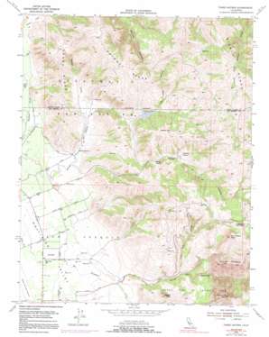
Three Sisters Topo Map California
To zoom in, hover over the map of Three Sisters
USGS Topo Quad 36121h3 - 1:24,000 scale
| Topo Map Name: | Three Sisters |
| USGS Topo Quad ID: | 36121h3 |
| Print Size: | ca. 21 1/4" wide x 27" high |
| Southeast Coordinates: | 36.875° N latitude / 121.25° W longitude |
| Map Center Coordinates: | 36.9375° N latitude / 121.3125° W longitude |
| U.S. State: | CA |
| Filename: | o36121h3.jpg |
| Download Map JPG Image: | Three Sisters topo map 1:24,000 scale |
| Map Type: | Topographic |
| Topo Series: | 7.5´ |
| Map Scale: | 1:24,000 |
| Source of Map Images: | United States Geological Survey (USGS) |
| Alternate Map Versions: |
Three Sisters CA 1954, updated 1956 Download PDF Buy paper map Three Sisters CA 1954, updated 1966 Download PDF Buy paper map Three Sisters CA 1954, updated 1972 Download PDF Buy paper map Three Sisters CA 1954, updated 1985 Download PDF Buy paper map Three Sisters CA 1954, updated 1991 Download PDF Buy paper map Three Sisters CA 2012 Download PDF Buy paper map Three Sisters CA 2015 Download PDF Buy paper map |
1:24,000 Topo Quads surrounding Three Sisters
> Back to 36121e1 at 1:100,000 scale
> Back to 36120a1 at 1:250,000 scale
> Back to U.S. Topo Maps home
Three Sisters topo map: Gazetteer
Three Sisters: Dams
Hawkins 651 Dam elevation 199m 652′Three Sisters: Reservoirs
Hawkins Lake elevation 199m 652′Three Sisters: Ridges
Chimney Ridge elevation 473m 1551′Dunne Ridge elevation 341m 1118′
Three Sisters: Streams
Lone Tree Creek elevation 243m 797′Sulfur Creek elevation 140m 459′
Three Sisters: Summits
Coyote Peak elevation 471m 1545′Messic Mountain elevation 541m 1774′
San Joaquin Peak elevation 878m 2880′
Santa Ana Mountain elevation 931m 3054′
Three Sisters elevation 887m 2910′
Three Sisters: Valleys
Little Peak Canyon elevation 213m 698′Wildcat Canyon elevation 421m 1381′
Three Sisters digital topo map on disk
Buy this Three Sisters topo map showing relief, roads, GPS coordinates and other geographical features, as a high-resolution digital map file on DVD:


