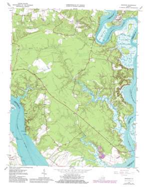
Brandon Topo Map Virginia
To zoom in, hover over the map of Brandon
USGS Topo Quad 37076c8 - 1:24,000 scale
| Topo Map Name: | Brandon |
| USGS Topo Quad ID: | 37076c8 |
| Print Size: | ca. 21 1/4" wide x 27" high |
| Southeast Coordinates: | 37.25° N latitude / 76.875° W longitude |
| Map Center Coordinates: | 37.3125° N latitude / 76.9375° W longitude |
| U.S. State: | VA |
| Filename: | o37076c8.jpg |
| Download Map JPG Image: | Brandon topo map 1:24,000 scale |
| Map Type: | Topographic |
| Topo Series: | 7.5´ |
| Map Scale: | 1:24,000 |
| Source of Map Images: | United States Geological Survey (USGS) |
| Alternate Map Versions: |
Brandon VA 1952, updated 1957 Download PDF Buy paper map Brandon VA 1965, updated 1967 Download PDF Buy paper map Brandon VA 1965, updated 1980 Download PDF Buy paper map Brandon VA 1965, updated 1984 Download PDF Buy paper map Brandon VA 1978, updated 1983 Download PDF Buy paper map Brandon VA 2011 Download PDF Buy paper map Brandon VA 2013 Download PDF Buy paper map Brandon VA 2016 Download PDF Buy paper map |
1:24,000 Topo Quads surrounding Brandon
> Back to 37076a1 at 1:100,000 scale
> Back to 37076a1 at 1:250,000 scale
> Back to U.S. Topo Maps home
Brandon topo map: Gazetteer
Brandon: Bars
Belfast Bank elevation 0m 0′Brandon: Bends
Eagle Bottom elevation 0m 0′Brandon: Bridges
Adams Bridge elevation 12m 39′Chickahominy Bridge elevation 0m 0′
Horse Bridge elevation 7m 22′
Brandon: Capes
Bachelor Point elevation 2m 6′Big Marsh Point elevation 1m 3′
Blank Point elevation 1m 3′
Brandon Point elevation 0m 0′
Ferry Point elevation 0m 0′
Lower Trees Point elevation 0m 0′
Old Neck elevation 5m 16′
Pig Point elevation 0m 0′
Trees Point elevation 2m 6′
Watts Point elevation 0m 0′
Brandon: Crossings
Barrets Ferry (historical) elevation 0m 0′Brandon: Guts
Old Neck Creek elevation 1m 3′The Thorofare elevation 2m 6′
Brandon: Islands
Parsons Island elevation 14m 45′Brandon: Parks
Chickahominy State Wildlife Management Area elevation 14m 45′Brandon: Populated Places
Blanks Store elevation 15m 49′Brandon elevation 6m 19′
Brickyard Landing elevation 4m 13′
Chickahominy Haven elevation 4m 13′
Holdcroft elevation 39m 127′
Kennon elevation 14m 45′
Lower Brandon elevation 0m 0′
Mount Airy elevation 25m 82′
Rustic elevation 14m 45′
The Row elevation 2m 6′
Brandon: Streams
Gordon Creek elevation 0m 0′Howard Creek elevation 0m 0′
Kennon Creek elevation 0m 0′
Morris Creek elevation 0m 0′
Nettles Creek elevation -1m -4′
Parson Creek elevation 0m 0′
Brandon: Swamps
Sunken Marsh elevation 0m 0′Brandon digital topo map on disk
Buy this Brandon topo map showing relief, roads, GPS coordinates and other geographical features, as a high-resolution digital map file on DVD:
Atlantic Coast (NY, NJ, PA, DE, MD, VA, NC)
Buy digital topo maps: Atlantic Coast (NY, NJ, PA, DE, MD, VA, NC)


