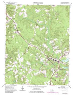
Gloucester Topo Map Virginia
To zoom in, hover over the map of Gloucester
USGS Topo Quad 37076d5 - 1:24,000 scale
| Topo Map Name: | Gloucester |
| USGS Topo Quad ID: | 37076d5 |
| Print Size: | ca. 21 1/4" wide x 27" high |
| Southeast Coordinates: | 37.375° N latitude / 76.5° W longitude |
| Map Center Coordinates: | 37.4375° N latitude / 76.5625° W longitude |
| U.S. State: | VA |
| Filename: | o37076d5.jpg |
| Download Map JPG Image: | Gloucester topo map 1:24,000 scale |
| Map Type: | Topographic |
| Topo Series: | 7.5´ |
| Map Scale: | 1:24,000 |
| Source of Map Images: | United States Geological Survey (USGS) |
| Alternate Map Versions: |
Gloucester VA 1952, updated 1957 Download PDF Buy paper map Gloucester VA 1953, updated 1953 Download PDF Buy paper map Gloucester VA 1965, updated 1967 Download PDF Buy paper map Gloucester VA 1965, updated 1974 Download PDF Buy paper map Gloucester VA 1965, updated 1986 Download PDF Buy paper map Gloucester VA 1965, updated 1986 Download PDF Buy paper map Gloucester VA 2010 Download PDF Buy paper map Gloucester VA 2013 Download PDF Buy paper map Gloucester VA 2016 Download PDF Buy paper map |
1:24,000 Topo Quads surrounding Gloucester
> Back to 37076a1 at 1:100,000 scale
> Back to 37076a1 at 1:250,000 scale
> Back to U.S. Topo Maps home
Gloucester topo map: Gazetteer
Gloucester: Airports
Francis J Mellar Field elevation 23m 75′Riverside Middle Peninsula Hospital Heliport elevation 18m 59′
Gloucester: Bridges
Fiddlers Bridge elevation 4m 13′Gloucester: Capes
Deacons Neck elevation 18m 59′Gloucester: Lakes
Lee Pond elevation 8m 26′Stubbs Pond elevation 6m 19′
Gloucester: Populated Places
Ark elevation 25m 82′Bacons Quarters (historical) elevation 32m 104′
Bellamy elevation 23m 75′
Belroi elevation 26m 85′
Cappahosic Estates Mobile Home Park elevation 24m 78′
Edgehill elevation 20m 65′
Gloucester elevation 22m 72′
Gloucester Courthouse elevation 10m 32′
Marlfield elevation 28m 91′
Money elevation 24m 78′
Pinero elevation 32m 104′
Sassafras elevation 28m 91′
Valley Front (historical) elevation 22m 72′
Wan elevation 24m 78′
Wareham (historical) elevation 24m 78′
Woods Crossroads elevation 32m 104′
Gloucester: Post Offices
Ark Post Office elevation 25m 82′Bellamy Post Office elevation 24m 78′
Gloucester Post Office elevation 22m 72′
Gloucester: Reservoirs
Beaverdam Swamp Reservoir elevation 4m 13′Leigh Pond elevation 4m 13′
Gloucester: Streams
Beech Swamp elevation 6m 19′Crany Creek elevation 7m 22′
Gloucester: Summits
Church Hill elevation 30m 98′Gloucester digital topo map on disk
Buy this Gloucester topo map showing relief, roads, GPS coordinates and other geographical features, as a high-resolution digital map file on DVD:
Atlantic Coast (NY, NJ, PA, DE, MD, VA, NC)
Buy digital topo maps: Atlantic Coast (NY, NJ, PA, DE, MD, VA, NC)


