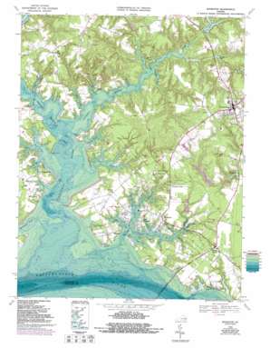
Irvington Topo Map Virginia
To zoom in, hover over the map of Irvington
USGS Topo Quad 37076f4 - 1:24,000 scale
| Topo Map Name: | Irvington |
| USGS Topo Quad ID: | 37076f4 |
| Print Size: | ca. 21 1/4" wide x 27" high |
| Southeast Coordinates: | 37.625° N latitude / 76.375° W longitude |
| Map Center Coordinates: | 37.6875° N latitude / 76.4375° W longitude |
| U.S. State: | VA |
| Filename: | o37076f4.jpg |
| Download Map JPG Image: | Irvington topo map 1:24,000 scale |
| Map Type: | Topographic |
| Topo Series: | 7.5´ |
| Map Scale: | 1:24,000 |
| Source of Map Images: | United States Geological Survey (USGS) |
| Alternate Map Versions: |
Irvington VA 1949 Download PDF Buy paper map Irvington VA 1949 Download PDF Buy paper map Irvington VA 1968, updated 1971 Download PDF Buy paper map Irvington VA 1968, updated 1980 Download PDF Buy paper map Irvington VA 1968, updated 1987 Download PDF Buy paper map Irvington VA 1968, updated 1991 Download PDF Buy paper map Irvington VA 1968, updated 1993 Download PDF Buy paper map Irvington VA 1968, updated 1993 Download PDF Buy paper map Irvington VA 2010 Download PDF Buy paper map Irvington VA 2013 Download PDF Buy paper map Irvington VA 2016 Download PDF Buy paper map |
1:24,000 Topo Quads surrounding Irvington
> Back to 37076e1 at 1:100,000 scale
> Back to 37076a1 at 1:250,000 scale
> Back to U.S. Topo Maps home
Irvington topo map: Gazetteer
Irvington: Airports
Irvington Marina Seaplane Base elevation 0m 0′Rappahannock General Hospital Heliport elevation 22m 72′
Weems Landing Strip elevation 5m 16′
Irvington: Bays
Bridge Cove elevation 8m 26′Calf Pasture Cove elevation 0m 0′
Carter Cove elevation 0m 0′
Currell Cove elevation 0m 0′
Dead and Bones Cove elevation 1m 3′
Dunton Cove elevation 5m 16′
Jack Cove elevation 1m 3′
James Cove elevation 0m 0′
Old Mill Cove elevation 6m 19′
Punches Cove elevation 6m 19′
Quarter Cove elevation 2m 6′
Sams Cove elevation 6m 19′
Yopps Cove elevation 2m 6′
Irvington: Beaches
White Stone Beach elevation 2m 6′Irvington: Bridges
Carters Creek Bridge elevation -3m -10′Irvington: Capes
Ball Point elevation 0m 0′Bar Point elevation 0m 0′
Black Stump Point elevation 4m 13′
Calf Pasture Point elevation 2m 6′
Cherry Point elevation 13m 42′
Corrotoman Point elevation 3m 9′
Crab Point elevation 2m 6′
Galley Hook Point elevation 2m 6′
John Neck elevation 5m 16′
John Neck Point elevation 3m 9′
Laurel Point elevation 16m 52′
Merry Point elevation 3m 9′
Orchard Point elevation 1m 3′
Rowes Point elevation 0m 0′
Sloop Landing Point elevation 1m 3′
Stevens Neck elevation 6m 19′
West Point elevation 0m 0′
Yankee Point elevation 3m 9′
Irvington: Crossings
Merry Point Ferry elevation 0m 0′Irvington: Dams
Golden Eagle Dam elevation 12m 39′Lancaster Roller Mill Dam elevation 4m 13′
Stevens Dam elevation 1m 3′
Irvington: Flats
Devils Bottom elevation 2m 6′Irvington: Harbors
Port of Rappahannock (historical) elevation 2m 6′Irvington: Populated Places
Christ Church elevation 9m 29′Cove Colony elevation 6m 19′
Dunton (historical) elevation 3m 9′
Iberis elevation 12m 39′
Irvington elevation 10m 32′
Kilmarnock elevation 27m 88′
Merry Point elevation 26m 85′
Millenbeck elevation 8m 26′
North Weems elevation 4m 13′
Pitmans Corner elevation 9m 29′
Queenstown elevation 6m 19′
Slabtown elevation 10m 32′
Taft elevation 12m 39′
Weems elevation 3m 9′
West Irvington elevation 7m 22′
Wharton Grove (historical) elevation 3m 9′
White Stone elevation 15m 49′
Irvington: Post Offices
Taft Post Office (historical) elevation 12m 39′Irvington: Reservoirs
Camps Millpond elevation 4m 13′Duntons Millpond elevation 3m 9′
Golden Eagle Pond elevation 12m 39′
Norris Pond elevation 4m 13′
Stevens Lake elevation 1m 3′
Irvington: Streams
Bells Creek elevation 1m 3′Browns Creek elevation 3m 9′
Camps Prong elevation 2m 6′
Carter Creek elevation 0m 0′
Church Prong elevation 0m 0′
Corrotoman River elevation 0m 0′
Eastern Branch Carter Creek elevation 0m 0′
Eastern Branch Corrotoman River elevation 0m 0′
Hills Creek elevation 0m 0′
John Creek elevation 0m 0′
Lowrey Creek elevation 0m 0′
Moran Creek elevation 0m 0′
Myer Creek elevation 0m 0′
Norris Prong elevation 3m 9′
Taylor Creek elevation 0m 0′
Town Creek elevation 0m 0′
Western Branch Corrotoman River elevation 0m 0′
Western Branch Taylors Creek elevation 0m 0′
Whitehouse Creek elevation 0m 0′
Irvington: Swamps
Bridge Marsh elevation 2m 6′Irvington: Valleys
Sanders Cove elevation 2m 6′Irvington digital topo map on disk
Buy this Irvington topo map showing relief, roads, GPS coordinates and other geographical features, as a high-resolution digital map file on DVD:
Atlantic Coast (NY, NJ, PA, DE, MD, VA, NC)
Buy digital topo maps: Atlantic Coast (NY, NJ, PA, DE, MD, VA, NC)


