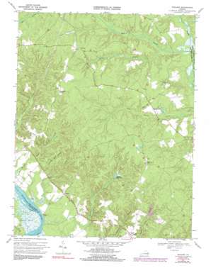
Truhart Topo Map Virginia
To zoom in, hover over the map of Truhart
USGS Topo Quad 37076f7 - 1:24,000 scale
| Topo Map Name: | Truhart |
| USGS Topo Quad ID: | 37076f7 |
| Print Size: | ca. 21 1/4" wide x 27" high |
| Southeast Coordinates: | 37.625° N latitude / 76.75° W longitude |
| Map Center Coordinates: | 37.6875° N latitude / 76.8125° W longitude |
| U.S. State: | VA |
| Filename: | o37076f7.jpg |
| Download Map JPG Image: | Truhart topo map 1:24,000 scale |
| Map Type: | Topographic |
| Topo Series: | 7.5´ |
| Map Scale: | 1:24,000 |
| Source of Map Images: | United States Geological Survey (USGS) |
| Alternate Map Versions: |
Truhart VA 1949 Download PDF Buy paper map Truhart VA 1968, updated 1971 Download PDF Buy paper map Truhart VA 1968, updated 1986 Download PDF Buy paper map Truhart VA 1970, updated 1984 Download PDF Buy paper map Truhart VA 1970, updated 1991 Download PDF Buy paper map Truhart VA 2011 Download PDF Buy paper map Truhart VA 2013 Download PDF Buy paper map Truhart VA 2016 Download PDF Buy paper map |
1:24,000 Topo Quads surrounding Truhart
> Back to 37076e1 at 1:100,000 scale
> Back to 37076a1 at 1:250,000 scale
> Back to U.S. Topo Maps home
Truhart topo map: Gazetteer
Truhart: Beaches
Davis Beach elevation 2m 6′Truhart: Dams
Allens Mill Dam elevation 17m 55′Normans Dam elevation 20m 65′
Townsend Dam elevation 28m 91′
Truhart: Populated Places
Allen Shop Corner elevation 51m 167′Carlton Corner elevation 48m 157′
Dragonville elevation 35m 114′
Little Plymouth elevation 34m 111′
Truhart elevation 18m 59′
Truhart: Reservoirs
Allens Millpond elevation 17m 55′Truhart: Streams
Carlton Hill Swamp elevation 16m 52′Exol Swamp elevation 26m 85′
Grass Creek elevation 1m 3′
Holmes Swamp elevation 24m 78′
Nell Branch elevation 31m 101′
Truhart: Swamps
Gleason Marsh elevation 1m 3′Truhart digital topo map on disk
Buy this Truhart topo map showing relief, roads, GPS coordinates and other geographical features, as a high-resolution digital map file on DVD:
Atlantic Coast (NY, NJ, PA, DE, MD, VA, NC)
Buy digital topo maps: Atlantic Coast (NY, NJ, PA, DE, MD, VA, NC)


