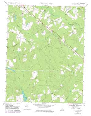
Disputanta South Topo Map Virginia
To zoom in, hover over the map of Disputanta South
USGS Topo Quad 37077a2 - 1:24,000 scale
| Topo Map Name: | Disputanta South |
| USGS Topo Quad ID: | 37077a2 |
| Print Size: | ca. 21 1/4" wide x 27" high |
| Southeast Coordinates: | 37° N latitude / 77.125° W longitude |
| Map Center Coordinates: | 37.0625° N latitude / 77.1875° W longitude |
| U.S. State: | VA |
| Filename: | o37077a2.jpg |
| Download Map JPG Image: | Disputanta South topo map 1:24,000 scale |
| Map Type: | Topographic |
| Topo Series: | 7.5´ |
| Map Scale: | 1:24,000 |
| Source of Map Images: | United States Geological Survey (USGS) |
| Alternate Map Versions: |
Disputanta South VA 1956, updated 1958 Download PDF Buy paper map Disputanta South VA 1968, updated 1970 Download PDF Buy paper map Disputanta South VA 1968, updated 1975 Download PDF Buy paper map Disputanta South VA 1968, updated 1982 Download PDF Buy paper map Disputanta South VA 2011 Download PDF Buy paper map Disputanta South VA 2013 Download PDF Buy paper map Disputanta South VA 2016 Download PDF Buy paper map |
1:24,000 Topo Quads surrounding Disputanta South
> Back to 37077a1 at 1:100,000 scale
> Back to 37076a1 at 1:250,000 scale
> Back to U.S. Topo Maps home
Disputanta South topo map: Gazetteer
Disputanta South: Bridges
Cooks Bridge elevation 17m 55′Disputanta South: Dams
Game Reserve Dam elevation 22m 72′Nebletts Dam elevation 17m 55′
Van Metre Dam elevation 35m 114′
Wright Dam elevation 27m 88′
Disputanta South: Populated Places
Disputanta elevation 30m 98′Laurel Springs Crossroads elevation 34m 111′
Newville elevation 37m 121′
Disputanta South: Post Offices
Disputanta Post Office elevation 32m 104′Disputanta South: Reservoirs
Josephs Mill Pond elevation 22m 72′Nebletts Millpond elevation 17m 55′
Wright Pond elevation 27m 88′
Disputanta South: Streams
Black Swamp elevation 24m 78′Blackwater Swamp elevation 18m 59′
Cabin Branch elevation 18m 59′
Dobie Swamp elevation 11m 36′
Ivy Branch elevation 21m 68′
Joseph Swamp elevation 18m 59′
Pigeon Swamp elevation 25m 82′
Warwick Swamp elevation 18m 59′
Disputanta South digital topo map on disk
Buy this Disputanta South topo map showing relief, roads, GPS coordinates and other geographical features, as a high-resolution digital map file on DVD:
Atlantic Coast (NY, NJ, PA, DE, MD, VA, NC)
Buy digital topo maps: Atlantic Coast (NY, NJ, PA, DE, MD, VA, NC)


