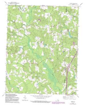
Carson Topo Map Virginia
To zoom in, hover over the map of Carson
USGS Topo Quad 37077a4 - 1:24,000 scale
| Topo Map Name: | Carson |
| USGS Topo Quad ID: | 37077a4 |
| Print Size: | ca. 21 1/4" wide x 27" high |
| Southeast Coordinates: | 37° N latitude / 77.375° W longitude |
| Map Center Coordinates: | 37.0625° N latitude / 77.4375° W longitude |
| U.S. State: | VA |
| Filename: | o37077a4.jpg |
| Download Map JPG Image: | Carson topo map 1:24,000 scale |
| Map Type: | Topographic |
| Topo Series: | 7.5´ |
| Map Scale: | 1:24,000 |
| Source of Map Images: | United States Geological Survey (USGS) |
| Alternate Map Versions: |
Reams VA 1952, updated 1959 Download PDF Buy paper map Carson VA 1969, updated 1971 Download PDF Buy paper map Carson VA 1969, updated 1975 Download PDF Buy paper map Carson VA 1969, updated 1981 Download PDF Buy paper map Carson VA 1969, updated 1987 Download PDF Buy paper map Carson VA 1969, updated 1987 Download PDF Buy paper map Carson VA 2010 Download PDF Buy paper map Carson VA 2013 Download PDF Buy paper map Carson VA 2016 Download PDF Buy paper map |
1:24,000 Topo Quads surrounding Carson
> Back to 37077a1 at 1:100,000 scale
> Back to 37076a1 at 1:250,000 scale
> Back to U.S. Topo Maps home
Carson topo map: Gazetteer
Carson: Bridges
Monkneck Bridge elevation 30m 98′Carson: Crossings
Interchange 37 elevation 37m 121′Shiloh Crossing (historical) elevation 46m 150′
Carson: Dams
Butterworth Dam elevation 33m 108′Cain Dam elevation 32m 104′
Indian Swamp Dam elevation 34m 111′
Perkins Dam elevation 30m 98′
Carson: Populated Places
Carson elevation 47m 154′Reams elevation 47m 154′
Rowanta elevation 37m 121′
Wedgewood Farms elevation 48m 157′
Carson: Post Offices
Carson Post Office elevation 46m 150′Carson: Reservoirs
Bodlies Pond elevation 40m 131′Butterworth Pond elevation 33m 108′
Indian Swamp Pond elevation 34m 111′
Laniers Millpond elevation 33m 108′
Perkins Pond elevation 30m 98′
Carson: Streams
Arthur Swamp elevation 33m 108′Brick Kiln Branch elevation 28m 91′
Fox Branch elevation 22m 72′
Gravelly Run elevation 31m 101′
Harvells Branch elevation 21m 68′
Hatcher Run elevation 30m 98′
Health Meadows Branch elevation 29m 95′
Little Cattail Creek elevation 30m 98′
Warren Swamp elevation 24m 78′
Carson digital topo map on disk
Buy this Carson topo map showing relief, roads, GPS coordinates and other geographical features, as a high-resolution digital map file on DVD:
Atlantic Coast (NY, NJ, PA, DE, MD, VA, NC)
Buy digital topo maps: Atlantic Coast (NY, NJ, PA, DE, MD, VA, NC)


