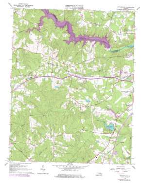
Sutherland Topo Map Virginia
To zoom in, hover over the map of Sutherland
USGS Topo Quad 37077b5 - 1:24,000 scale
| Topo Map Name: | Sutherland |
| USGS Topo Quad ID: | 37077b5 |
| Print Size: | ca. 21 1/4" wide x 27" high |
| Southeast Coordinates: | 37.125° N latitude / 77.5° W longitude |
| Map Center Coordinates: | 37.1875° N latitude / 77.5625° W longitude |
| U.S. State: | VA |
| Filename: | o37077b5.jpg |
| Download Map JPG Image: | Sutherland topo map 1:24,000 scale |
| Map Type: | Topographic |
| Topo Series: | 7.5´ |
| Map Scale: | 1:24,000 |
| Source of Map Images: | United States Geological Survey (USGS) |
| Alternate Map Versions: |
Sutherland VA 1943, updated 1961 Download PDF Buy paper map Sutherland VA 1963, updated 1965 Download PDF Buy paper map Sutherland VA 1963, updated 1972 Download PDF Buy paper map Sutherland VA 1963, updated 1975 Download PDF Buy paper map Sutherland VA 1963, updated 1975 Download PDF Buy paper map Sutherland VA 2010 Download PDF Buy paper map Sutherland VA 2013 Download PDF Buy paper map Sutherland VA 2016 Download PDF Buy paper map |
1:24,000 Topo Quads surrounding Sutherland
> Back to 37077a1 at 1:100,000 scale
> Back to 37076a1 at 1:250,000 scale
> Back to U.S. Topo Maps home
Sutherland topo map: Gazetteer
Sutherland: Airports
Petersburg Municipal Airport elevation 56m 183′Sutherland: Dams
Clarkes Dam elevation 58m 190′George F Brasfield Dam elevation 48m 157′
Lake Jordon Dam elevation 45m 147′
Picture Dam elevation 48m 157′
Stafford Brothers Dam elevation 66m 216′
Sutherland: Parks
Fort Lee Recreation Area elevation 58m 190′Sutherland: Populated Places
Addison elevation 60m 196′Beverly Acres elevation 65m 213′
Burgess elevation 58m 190′
Chesdin Manor elevation 57m 187′
Chestnut Gardens elevation 62m 203′
Clay Estates elevation 86m 282′
Dabney Estates elevation 75m 246′
Five Forks elevation 91m 298′
Hunters Green elevation 71m 232′
Jack elevation 58m 190′
Lakewood elevation 58m 190′
Oak Hill Estates elevation 74m 242′
Penmar Estates elevation 62m 203′
Sandy Ridge elevation 64m 209′
Sutherland elevation 88m 288′
Sutherland Manor elevation 75m 246′
Sutherland: Post Offices
Sutherland Post Office elevation 89m 291′Sutherland: Reservoirs
Brasfield Reservoir elevation 48m 157′Clarkes Lake elevation 58m 190′
Jordon Lake elevation 45m 147′
Lake Chesdin elevation 33m 108′
Lake Jordon elevation 45m 147′
Pamplins Pond elevation 57m 187′
Picture Lake elevation 48m 157′
Slates Pond elevation 79m 259′
Sutherland: Streams
Miry Run elevation 45m 147′Picture Branch elevation 40m 131′
Rocky Run elevation 45m 147′
Stoney Creek elevation 45m 147′
Wallace Creek elevation 36m 118′
Whipponock Creek elevation 45m 147′
Sutherland digital topo map on disk
Buy this Sutherland topo map showing relief, roads, GPS coordinates and other geographical features, as a high-resolution digital map file on DVD:
Atlantic Coast (NY, NJ, PA, DE, MD, VA, NC)
Buy digital topo maps: Atlantic Coast (NY, NJ, PA, DE, MD, VA, NC)


