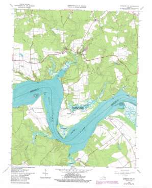
Charles City Topo Map Virginia
To zoom in, hover over the map of Charles City
USGS Topo Quad 37077c1 - 1:24,000 scale
| Topo Map Name: | Charles City |
| USGS Topo Quad ID: | 37077c1 |
| Print Size: | ca. 21 1/4" wide x 27" high |
| Southeast Coordinates: | 37.25° N latitude / 77° W longitude |
| Map Center Coordinates: | 37.3125° N latitude / 77.0625° W longitude |
| U.S. State: | VA |
| Filename: | o37077c1.jpg |
| Download Map JPG Image: | Charles City topo map 1:24,000 scale |
| Map Type: | Topographic |
| Topo Series: | 7.5´ |
| Map Scale: | 1:24,000 |
| Source of Map Images: | United States Geological Survey (USGS) |
| Alternate Map Versions: |
Charles City VA 1953, updated 1957 Download PDF Buy paper map Charles City VA 1965, updated 1967 Download PDF Buy paper map Charles City VA 1965, updated 1975 Download PDF Buy paper map Charles City VA 1965, updated 1985 Download PDF Buy paper map Charles City VA 1965, updated 1987 Download PDF Buy paper map Charles City VA 1979, updated 1983 Download PDF Buy paper map Charles City VA 2010 Download PDF Buy paper map Charles City VA 2013 Download PDF Buy paper map Charles City VA 2016 Download PDF Buy paper map |
1:24,000 Topo Quads surrounding Charles City
> Back to 37077a1 at 1:100,000 scale
> Back to 37076a1 at 1:250,000 scale
> Back to U.S. Topo Maps home
Charles City topo map: Gazetteer
Charles City: Areas
Wyanoke Neck elevation 9m 29′Charles City: Capes
Olds Point elevation 6m 19′Sturgeon Point elevation 1m 3′
Weyanoke Point elevation 9m 29′
Windmill Point elevation 4m 13′
Charles City: Channels
Sevenmile Reach elevation 0m 0′Threemile Reach elevation 0m 0′
Charles City: Dams
Cerneys Dam elevation 11m 36′Charles City: Flats
Flowerdew Hundred elevation 11m 36′Charles City: Populated Places
Charles City elevation 8m 26′Dunnmore elevation 17m 55′
Fort Powhatan elevation 17m 55′
Greenway elevation 13m 42′
Milton elevation 6m 19′
New Hope elevation 11m 36′
Ruthville elevation 23m 75′
Sherwood Forest elevation 24m 78′
Upper Brandon elevation 12m 39′
Weyanoke elevation 8m 26′
Willow Hill elevation 18m 59′
Charles City: Post Offices
Charles City Post Office elevation 12m 39′Ruthville Post Office elevation 29m 95′
Charles City: Reservoirs
Cerneys Pond elevation 11m 36′Charles City: Streams
Buckland Creek elevation 0m 0′Courthouse Creek elevation 6m 19′
Flowerdew Hundred Creek elevation 0m 0′
Glebe Creek elevation 1m 3′
Gunns Run elevation 2m 6′
Kittewan Creek elevation 0m 0′
Mapsico Creek elevation 14m 45′
Parrish Hill Creek elevation 6m 19′
Queens Creek elevation 0m 0′
Tyler Creek elevation 0m 0′
Wards Creek elevation 0m 0′
Charles City: Swamps
Kennon Marsh elevation 10m 32′Charles City digital topo map on disk
Buy this Charles City topo map showing relief, roads, GPS coordinates and other geographical features, as a high-resolution digital map file on DVD:
Atlantic Coast (NY, NJ, PA, DE, MD, VA, NC)
Buy digital topo maps: Atlantic Coast (NY, NJ, PA, DE, MD, VA, NC)


