Rubermont Topo Map Virginia
To zoom in, hover over the map of Rubermont
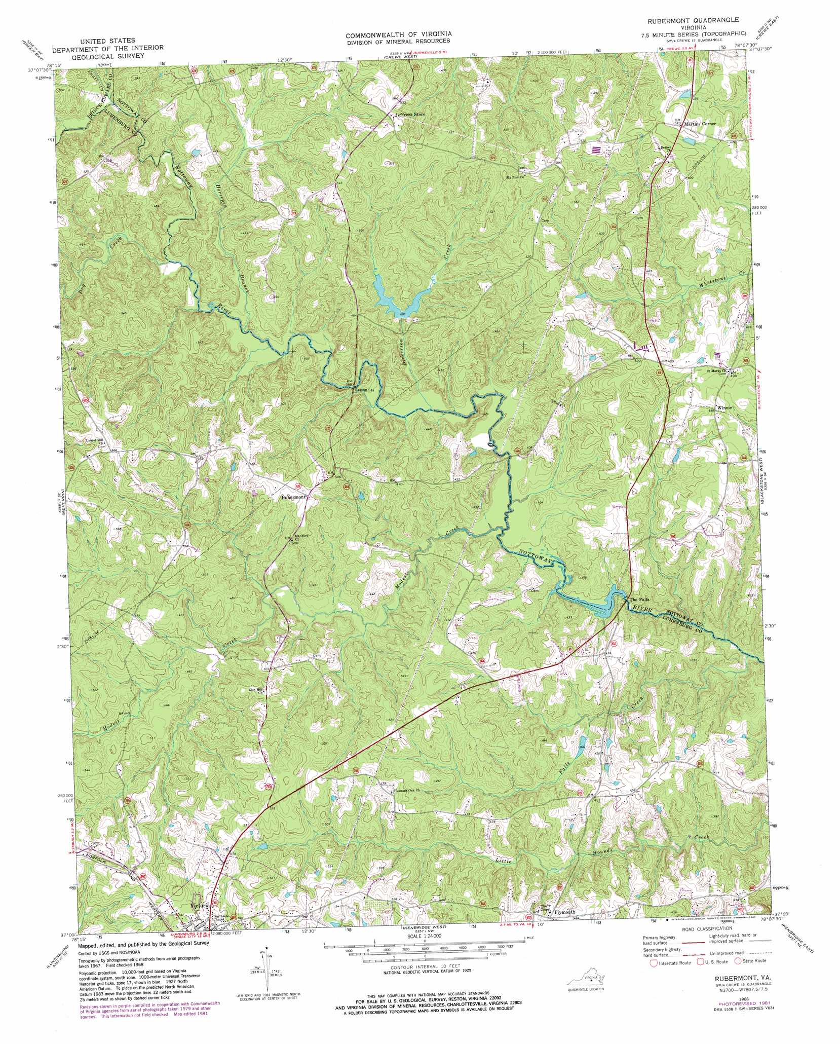
USGS Topo Quad 37078a2 - 1:24,000 scale
| Topo Map Name: | Rubermont |
| USGS Topo Quad ID: | 37078a2 |
| Print Size: | ca. 21 1/4" wide x 27" high |
| Southeast Coordinates: | 37° N latitude / 78.125° W longitude |
| Map Center Coordinates: | 37.0625° N latitude / 78.1875° W longitude |
| U.S. State: | VA |
| Filename: | o37078a2.jpg |
| Download Map JPG Image: | Rubermont topo map 1:24,000 scale |
| Map Type: | Topographic |
| Topo Series: | 7.5´ |
| Map Scale: | 1:24,000 |
| Source of Map Images: | United States Geological Survey (USGS) |
| Alternate Map Versions: |
Rubermont VA 1968, updated 1972 Download PDF Buy paper map Rubermont VA 1968, updated 1982 Download PDF Buy paper map Rubermont VA 2010 Download PDF Buy paper map Rubermont VA 2013 Download PDF Buy paper map Rubermont VA 2016 Download PDF Buy paper map |
1:24,000 Topo Quads surrounding Rubermont
Farmville |
Rice |
Deatonville |
Jetersville |
Amelia Court House |
Hampden Sydney |
Green Bay |
Crewe West |
Crewe East |
Wellville |
Keysville |
Meherrin |
Rubermont |
Blackstone West |
Blackstone East |
Fort Mitchell |
Lunenburg |
Kenbridge West |
Kenbridge East |
Danieltown |
Chase City |
Wightman |
North View |
Forksville |
Alberta |
> Back to 37078a1 at 1:100,000 scale
> Back to 37078a1 at 1:250,000 scale
> Back to U.S. Topo Maps home
Rubermont topo map: Gazetteer
Rubermont: Dams
Hamilton Dam elevation 124m 406′Modest Creek Dam elevation 124m 406′
Nottoway Falls Dam elevation 108m 354′
Rubermont: Populated Places
Martins Corner elevation 153m 501′Plymouth elevation 140m 459′
Rubermont elevation 154m 505′
Winnie elevation 148m 485′
Rubermont: Reservoirs
Hamilton Lake elevation 124m 406′Modest Creek Reservoir elevation 124m 406′
Nottoway Falls Reservoir elevation 108m 354′
Victoria Lake elevation 124m 406′
Victoria Lake (historical) elevation 125m 410′
Rubermont: Streams
Dickerson Creek elevation 107m 351′Dry Creek elevation 115m 377′
Falls Creek elevation 78m 255′
Horsepen Branch elevation 112m 367′
Modest Creek elevation 106m 347′
Snail Creek elevation 121m 396′
Rubermont digital topo map on disk
Buy this Rubermont topo map showing relief, roads, GPS coordinates and other geographical features, as a high-resolution digital map file on DVD:
Western Virginia & Southern West Virginia
Buy digital topo maps: Western Virginia & Southern West Virginia