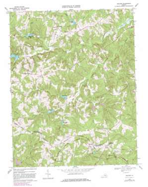
Abilene Topo Map Virginia
To zoom in, hover over the map of Abilene
USGS Topo Quad 37078b5 - 1:24,000 scale
| Topo Map Name: | Abilene |
| USGS Topo Quad ID: | 37078b5 |
| Print Size: | ca. 21 1/4" wide x 27" high |
| Southeast Coordinates: | 37.125° N latitude / 78.5° W longitude |
| Map Center Coordinates: | 37.1875° N latitude / 78.5625° W longitude |
| U.S. State: | VA |
| Filename: | o37078b5.jpg |
| Download Map JPG Image: | Abilene topo map 1:24,000 scale |
| Map Type: | Topographic |
| Topo Series: | 7.5´ |
| Map Scale: | 1:24,000 |
| Source of Map Images: | United States Geological Survey (USGS) |
| Alternate Map Versions: |
Abilene VA 1968, updated 1971 Download PDF Buy paper map Abilene VA 1968, updated 1979 Download PDF Buy paper map Abilene VA 1968, updated 1981 Download PDF Buy paper map Abilene VA 2010 Download PDF Buy paper map Abilene VA 2013 Download PDF Buy paper map Abilene VA 2016 Download PDF Buy paper map |
1:24,000 Topo Quads surrounding Abilene
> Back to 37078a1 at 1:100,000 scale
> Back to 37078a1 at 1:250,000 scale
> Back to U.S. Topo Maps home
Abilene topo map: Gazetteer
Abilene: Dams
Buffalo Creek Number Eight Dam elevation 135m 442′Buffalo Creek Number Five Dam elevation 137m 449′
Buffalo Creek Number Four Dam elevation 145m 475′
Buffalo Creek Number Nine Dam elevation 136m 446′
Buffalo Creek Number Seven Dam elevation 149m 488′
Buffalo Creek Number Six Dam elevation 135m 442′
Buffalo Creek Number Three Dam elevation 170m 557′
Buffalo Creek Number Two Dam elevation 131m 429′
Abilene: Populated Places
Abilene elevation 176m 577′County Line Cross Roads elevation 187m 613′
Darlington Heights elevation 183m 600′
Five Forks elevation 169m 554′
Tredway (historical) elevation 131m 429′
Abilene: Reservoirs
Bell Lake elevation 134m 439′Buffalo Lake elevation 138m 452′
Lake Gayle elevation 145m 475′
Little Creek Lake elevation 141m 462′
Spring Creek Lake elevation 138m 452′
Stockton Lake elevation 132m 433′
Abilene: Streams
Bell Creek elevation 132m 433′Browns Branch elevation 127m 416′
Carey Creek elevation 119m 390′
Caulk Branch elevation 133m 436′
Flintoy Creek elevation 138m 452′
Morris Branch elevation 125m 410′
Mud Creek elevation 121m 396′
Abilene digital topo map on disk
Buy this Abilene topo map showing relief, roads, GPS coordinates and other geographical features, as a high-resolution digital map file on DVD:
Western Virginia & Southern West Virginia
Buy digital topo maps: Western Virginia & Southern West Virginia


