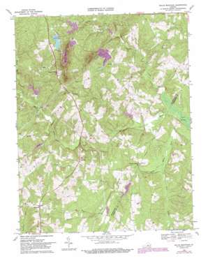
Willis Mountain Topo Map Virginia
To zoom in, hover over the map of Willis Mountain
USGS Topo Quad 37078d4 - 1:24,000 scale
| Topo Map Name: | Willis Mountain |
| USGS Topo Quad ID: | 37078d4 |
| Print Size: | ca. 21 1/4" wide x 27" high |
| Southeast Coordinates: | 37.375° N latitude / 78.375° W longitude |
| Map Center Coordinates: | 37.4375° N latitude / 78.4375° W longitude |
| U.S. State: | VA |
| Filename: | o37078d4.jpg |
| Download Map JPG Image: | Willis Mountain topo map 1:24,000 scale |
| Map Type: | Topographic |
| Topo Series: | 7.5´ |
| Map Scale: | 1:24,000 |
| Source of Map Images: | United States Geological Survey (USGS) |
| Alternate Map Versions: |
Willis Mountain VA 1968, updated 1971 Download PDF Buy paper map Willis Mountain VA 1968, updated 1975 Download PDF Buy paper map Willis Mountain VA 1968, updated 1982 Download PDF Buy paper map Willis Mountain VA 1968, updated 1987 Download PDF Buy paper map Willis Mountain VA 2010 Download PDF Buy paper map Willis Mountain VA 2013 Download PDF Buy paper map Willis Mountain VA 2016 Download PDF Buy paper map |
1:24,000 Topo Quads surrounding Willis Mountain
> Back to 37078a1 at 1:100,000 scale
> Back to 37078a1 at 1:250,000 scale
> Back to U.S. Topo Maps home
Willis Mountain topo map: Gazetteer
Willis Mountain: Dams
Kyanite Dam Number Three elevation 149m 488′Kyanite East Ridge Dam elevation 140m 459′
Kyanite Mine Waste Dam Number One elevation 166m 544′
Monroe, Melvin and Johns Dam elevation 111m 364′
Willis River Number 5f Dam elevation 112m 367′
Willis River Number Four Dam elevation 99m 324′
Willis River Number Six Dam elevation 103m 337′
Willis River Number Three Dam elevation 118m 387′
Willis River Number Two Dam elevation 114m 374′
Willis Mountain: Populated Places
Curdsville elevation 144m 472′Pleasant Valley elevation 166m 544′
Sheppards elevation 171m 561′
Willis Mountain: Reservoirs
East Ridge Pond elevation 149m 488′Willis Mountain: Streams
Bishop Creek elevation 105m 344′Brier Creek elevation 91m 298′
Cattail Creek elevation 91m 298′
Gills Creek elevation 112m 367′
Nelson Fork elevation 100m 328′
Perkins Creek elevation 103m 337′
Tongue Quarter Creek elevation 109m 357′
Whispering Creek elevation 87m 285′
Willis Mountain: Summits
Willis Mountain elevation 311m 1020′Willis Mountain: Swamps
Fork Swamp elevation 87m 285′Willis Mountain digital topo map on disk
Buy this Willis Mountain topo map showing relief, roads, GPS coordinates and other geographical features, as a high-resolution digital map file on DVD:
Western Virginia & Southern West Virginia
Buy digital topo maps: Western Virginia & Southern West Virginia


