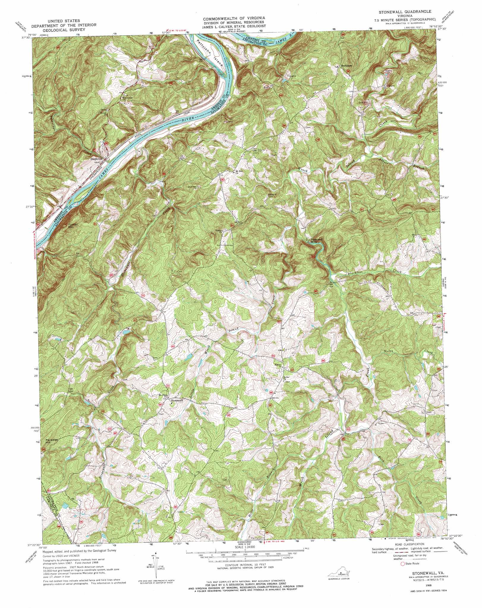
Stonewall Topo Map Virginia
To zoom in, hover over the map of Stonewall
USGS Topo Quad 37078d8 - 1:24,000 scale
| Topo Map Name: | Stonewall |
| USGS Topo Quad ID: | 37078d8 |
| Print Size: | ca. 21 1/4" wide x 27" high |
| Southeast Coordinates: | 37.375° N latitude / 78.875° W longitude |
| Map Center Coordinates: | 37.4375° N latitude / 78.9375° W longitude |
| U.S. State: | VA |
| Filename: | o37078d8.jpg |
| Download Map JPG Image: | Stonewall topo map 1:24,000 scale |
| Map Type: | Topographic |
| Topo Series: | 7.5´ |
| Map Scale: | 1:24,000 |
| Source of Map Images: | United States Geological Survey (USGS) |
| Alternate Map Versions: |
Stonewall VA 1968, updated 1971 Download PDF Buy paper map Stonewall VA 1968, updated 1977 Download PDF Buy paper map Stonewall VA 2010 Download PDF Buy paper map Stonewall VA 2013 Download PDF Buy paper map Stonewall VA 2016 Download PDF Buy paper map |
1:24,000 Topo Quads surrounding Stonewall
Forks Of Buffalo |
Piney River |
Arrington |
Shipman |
Howardsville |
Tobacco Row Mountain |
Amherst |
Buffalo Ridge |
Gladstone |
Saint Joy |
Lynchburg |
Kelly |
Stonewall |
Vera |
Holiday Lake |
City Farm |
Rustburg |
Concord |
Appomattox |
Pamplin |
Castle Craig |
Gladys |
Mike |
Red House |
Madisonville |
> Back to 37078a1 at 1:100,000 scale
> Back to 37078a1 at 1:250,000 scale
> Back to U.S. Topo Maps home
Stonewall topo map: Gazetteer
Stonewall: Airports
Skovhus Airport elevation 214m 702′Stonewall: Dams
Lawsons Dam elevation 226m 741′Stonewall: Islands
Pettyjohn Island elevation 135m 442′Stonewall: Populated Places
Beckham elevation 226m 741′Mineral (historical) elevation 214m 702′
Stapleton elevation 140m 459′
Stonewall elevation 227m 744′
Stonewall Mills elevation 152m 498′
Stonewall: Reservoirs
Lawsons Pond elevation 226m 741′Stonewall: Streams
Abbott Branch elevation 142m 465′Blackfoot Creek elevation 155m 508′
Buck Creek elevation 167m 547′
Holts Branch elevation 171m 561′
Little Wreck Island Creek elevation 148m 485′
North Creek elevation 161m 528′
Partridge Creek elevation 132m 433′
Stonewall Creek elevation 131m 429′
Walkers Ford Creek elevation 128m 419′
Stonewall: Summits
Paradise Hill elevation 267m 875′Turner Mountain elevation 259m 849′
Stonewall digital topo map on disk
Buy this Stonewall topo map showing relief, roads, GPS coordinates and other geographical features, as a high-resolution digital map file on DVD:
Western Virginia & Southern West Virginia
Buy digital topo maps: Western Virginia & Southern West Virginia