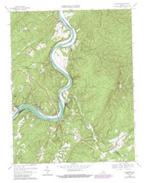
Gladstone Topo Map Virginia
To zoom in, hover over the map of Gladstone
USGS Topo Quad 37078e7 - 1:24,000 scale
| Topo Map Name: | Gladstone |
| USGS Topo Quad ID: | 37078e7 |
| Print Size: | ca. 21 1/4" wide x 27" high |
| Southeast Coordinates: | 37.5° N latitude / 78.75° W longitude |
| Map Center Coordinates: | 37.5625° N latitude / 78.8125° W longitude |
| U.S. State: | VA |
| Filename: | o37078e7.jpg |
| Download Map JPG Image: | Gladstone topo map 1:24,000 scale |
| Map Type: | Topographic |
| Topo Series: | 7.5´ |
| Map Scale: | 1:24,000 |
| Source of Map Images: | United States Geological Survey (USGS) |
| Alternate Map Versions: |
Gladstone VA 1969, updated 1971 Download PDF Buy paper map Gladstone VA 1969, updated 1977 Download PDF Buy paper map Gladstone VA 1969, updated 1987 Download PDF Buy paper map Gladstone VA 1969, updated 1987 Download PDF Buy paper map Gladstone VA 2010 Download PDF Buy paper map Gladstone VA 2013 Download PDF Buy paper map Gladstone VA 2016 Download PDF Buy paper map |
1:24,000 Topo Quads surrounding Gladstone
> Back to 37078e1 at 1:100,000 scale
> Back to 37078a1 at 1:250,000 scale
> Back to U.S. Topo Maps home
Gladstone topo map: Gazetteer
Gladstone: Crossings
Migginsons Ferry (historical) elevation 111m 364′Gladstone: Islands
Smith Islands elevation 122m 400′Gladstone: Populated Places
Allens Creek elevation 127m 416′Bent Creek elevation 127m 416′
Buffalo Springs elevation 177m 580′
Caskie elevation 122m 400′
Eldridge Corner elevation 152m 498′
Five Forks elevation 187m 613′
Four Forks elevation 187m 613′
Gladstone elevation 127m 416′
Greenway elevation 115m 377′
Gladstone: Ridges
Bible Ridge elevation 191m 626′Sears Ridge elevation 194m 636′
Gladstone: Streams
Alabama Creek elevation 110m 360′Allens Creek elevation 121m 396′
Bent Creek elevation 116m 380′
Brick Kiln Branch elevation 154m 505′
Carter Creek elevation 115m 377′
David Creek elevation 115m 377′
Iron Branch elevation 173m 567′
Mack Brandon Branch elevation 141m 462′
North Branch Brick Kiln Branch elevation 164m 538′
Owens Creek elevation 108m 354′
Seven Branch elevation 121m 396′
Stevens Run elevation 145m 475′
Gladstone: Summits
Buck Mountain elevation 306m 1003′Buck Mountain elevation 253m 830′
Cove Mountain elevation 287m 941′
Pruetts Mountain elevation 421m 1381′
Spears Mountain elevation 491m 1610′
Gladstone: Valleys
Jack Wrights Hollow elevation 136m 446′Negro Den Hollow elevation 116m 380′
Gladstone digital topo map on disk
Buy this Gladstone topo map showing relief, roads, GPS coordinates and other geographical features, as a high-resolution digital map file on DVD:
Western Virginia & Southern West Virginia
Buy digital topo maps: Western Virginia & Southern West Virginia


