Long Island Topo Map Virginia
To zoom in, hover over the map of Long Island
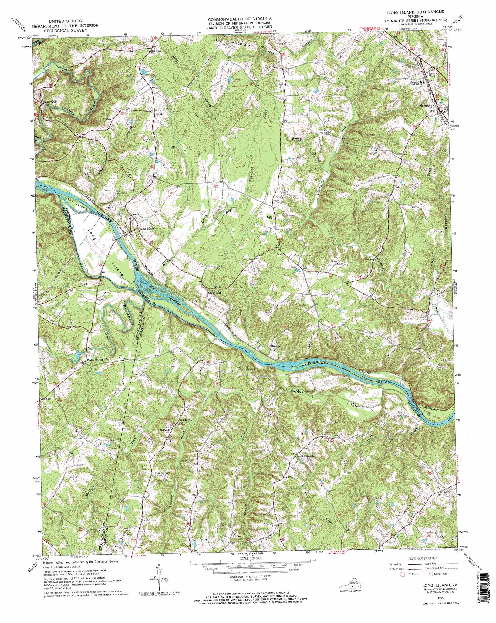
USGS Topo Quad 37079a1 - 1:24,000 scale
| Topo Map Name: | Long Island |
| USGS Topo Quad ID: | 37079a1 |
| Print Size: | ca. 21 1/4" wide x 27" high |
| Southeast Coordinates: | 37° N latitude / 79° W longitude |
| Map Center Coordinates: | 37.0625° N latitude / 79.0625° W longitude |
| U.S. State: | VA |
| Filename: | o37079a1.jpg |
| Download Map JPG Image: | Long Island topo map 1:24,000 scale |
| Map Type: | Topographic |
| Topo Series: | 7.5´ |
| Map Scale: | 1:24,000 |
| Source of Map Images: | United States Geological Survey (USGS) |
| Alternate Map Versions: |
Long Island VA 1966, updated 1968 Download PDF Buy paper map Long Island VA 1966, updated 1968 Download PDF Buy paper map Long Island VA 2010 Download PDF Buy paper map Long Island VA 2013 Download PDF Buy paper map Long Island VA 2016 Download PDF Buy paper map |
1:24,000 Topo Quads surrounding Long Island
Forest |
City Farm |
Rustburg |
Concord |
Appomattox |
Lynch Station |
Castle Craig |
Gladys |
Mike |
Red House |
Altavista |
Straightstone |
Long Island |
Brookneal |
Aspen |
Gretna |
Mount Airy |
Republican Grove |
Nathalie |
Conner Lake |
Spring Garden |
Java |
Vernon Hill |
Halifax |
Scottsburg |
> Back to 37079a1 at 1:100,000 scale
> Back to 37078a1 at 1:250,000 scale
> Back to U.S. Topo Maps home
Long Island topo map: Gazetteer
Long Island: Dams
Cedar Forest Mill Dam elevation 159m 521′Long Island: Islands
Goat Island elevation 141m 462′Hale Islands elevation 133m 436′
Long Island elevation 140m 459′
Long Island: Populated Places
Cedar Forest elevation 162m 531′Green Hill elevation 169m 554′
Long Island elevation 170m 557′
Marysville elevation 165m 541′
Melrose elevation 155m 508′
Naruna elevation 201m 659′
Long Island: Streams
Buck Branch elevation 142m 465′Buffalo Creek elevation 121m 396′
Bull Creek elevation 123m 403′
Cherry Creek elevation 131m 429′
Dry Mountain Creek elevation 145m 475′
Little Whipping Creek elevation 125m 410′
Long Branch elevation 137m 449′
Rocky Branch elevation 142m 465′
Seneca Creek elevation 140m 459′
Straightstone Creek elevation 134m 439′
Tinsley Creek elevation 137m 449′
Long Island: Summits
Dry Mountain elevation 208m 682′Long Island digital topo map on disk
Buy this Long Island topo map showing relief, roads, GPS coordinates and other geographical features, as a high-resolution digital map file on DVD:
Western Virginia & Southern West Virginia
Buy digital topo maps: Western Virginia & Southern West Virginia