Straightstone Topo Map Virginia
To zoom in, hover over the map of Straightstone
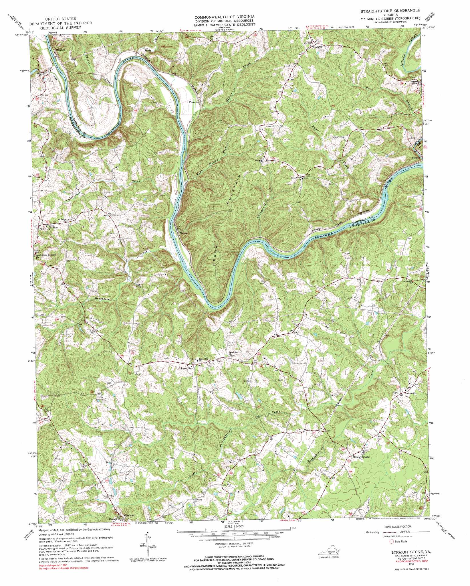
USGS Topo Quad 37079a2 - 1:24,000 scale
| Topo Map Name: | Straightstone |
| USGS Topo Quad ID: | 37079a2 |
| Print Size: | ca. 21 1/4" wide x 27" high |
| Southeast Coordinates: | 37° N latitude / 79.125° W longitude |
| Map Center Coordinates: | 37.0625° N latitude / 79.1875° W longitude |
| U.S. State: | VA |
| Filename: | o37079a2.jpg |
| Download Map JPG Image: | Straightstone topo map 1:24,000 scale |
| Map Type: | Topographic |
| Topo Series: | 7.5´ |
| Map Scale: | 1:24,000 |
| Source of Map Images: | United States Geological Survey (USGS) |
| Alternate Map Versions: |
Straightstone VA 1966, updated 1968 Download PDF Buy paper map Straightstone VA 1966, updated 1985 Download PDF Buy paper map Straightstone VA 2010 Download PDF Buy paper map Straightstone VA 2013 Download PDF Buy paper map Straightstone VA 2016 Download PDF Buy paper map |
1:24,000 Topo Quads surrounding Straightstone
Goode |
Forest |
City Farm |
Rustburg |
Concord |
Huddleston |
Lynch Station |
Castle Craig |
Gladys |
Mike |
Leesville |
Altavista |
Straightstone |
Long Island |
Brookneal |
Pittsville |
Gretna |
Mount Airy |
Republican Grove |
Nathalie |
Chatham |
Spring Garden |
Java |
Vernon Hill |
Halifax |
> Back to 37079a1 at 1:100,000 scale
> Back to 37078a1 at 1:250,000 scale
> Back to U.S. Topo Maps home
Straightstone topo map: Gazetteer
Straightstone: Airports
Worshams Pasture Ultralight Airport elevation 181m 593′Straightstone: Bridges
Mansion Truss Bridge elevation 151m 495′Straightstone: Dams
Dews Dam elevation 205m 672′Straightstone: Populated Places
Grit elevation 239m 784′Hodges elevation 232m 761′
Level Run elevation 218m 715′
Perrows elevation 167m 547′
Seneca elevation 147m 482′
Straightstone elevation 191m 626′
Taber elevation 152m 498′
Straightstone: Streams
Beechtree Creek elevation 146m 479′Catamount Creek elevation 145m 475′
Cheese Creek elevation 149m 488′
Hills Creek elevation 149m 488′
Little Straightstone Creek elevation 160m 524′
Mill Creek elevation 151m 495′
Mink Hollow Branch elevation 148m 485′
Minter Creek elevation 150m 492′
Swan Creek elevation 140m 459′
Valentine Creek elevation 147m 482′
Straightstone: Summits
Brown Mountain elevation 275m 902′Straightstone digital topo map on disk
Buy this Straightstone topo map showing relief, roads, GPS coordinates and other geographical features, as a high-resolution digital map file on DVD:
Western Virginia & Southern West Virginia
Buy digital topo maps: Western Virginia & Southern West Virginia