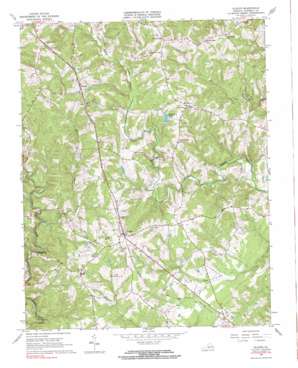
Gladys Topo Map Virginia
To zoom in, hover over the map of Gladys
USGS Topo Quad 37079b1 - 1:24,000 scale
| Topo Map Name: | Gladys |
| USGS Topo Quad ID: | 37079b1 |
| Print Size: | ca. 21 1/4" wide x 27" high |
| Southeast Coordinates: | 37.125° N latitude / 79° W longitude |
| Map Center Coordinates: | 37.1875° N latitude / 79.0625° W longitude |
| U.S. State: | VA |
| Filename: | o37079b1.jpg |
| Download Map JPG Image: | Gladys topo map 1:24,000 scale |
| Map Type: | Topographic |
| Topo Series: | 7.5´ |
| Map Scale: | 1:24,000 |
| Source of Map Images: | United States Geological Survey (USGS) |
| Alternate Map Versions: |
Gladys VA 1966, updated 1968 Download PDF Buy paper map Gladys VA 1966, updated 1984 Download PDF Buy paper map Gladys VA 1966, updated 1984 Download PDF Buy paper map Gladys VA 2010 Download PDF Buy paper map Gladys VA 2013 Download PDF Buy paper map Gladys VA 2016 Download PDF Buy paper map |
1:24,000 Topo Quads surrounding Gladys
> Back to 37079a1 at 1:100,000 scale
> Back to 37078a1 at 1:250,000 scale
> Back to U.S. Topo Maps home
Gladys topo map: Gazetteer
Gladys: Airports
Brookneal-Campbell County Airport elevation 182m 597′Gladys: Dams
Farmer Dam elevation 207m 679′Grandview Lake Dam elevation 203m 666′
Gladys: Populated Places
Diamond Hill elevation 224m 734′Gladys elevation 238m 780′
Mitchell Mill elevation 186m 610′
Mount Zion elevation 235m 770′
Three Forks elevation 258m 846′
Winfall elevation 260m 853′
Gladys: Reservoirs
Grandview Lake elevation 209m 685′Gladys: Streams
East Little Seneca Creek elevation 175m 574′Gladys digital topo map on disk
Buy this Gladys topo map showing relief, roads, GPS coordinates and other geographical features, as a high-resolution digital map file on DVD:
Western Virginia & Southern West Virginia
Buy digital topo maps: Western Virginia & Southern West Virginia


