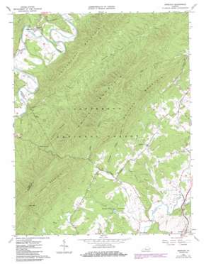
Oriskany Topo Map Virginia
To zoom in, hover over the map of Oriskany
USGS Topo Quad 37079e8 - 1:24,000 scale
| Topo Map Name: | Oriskany |
| USGS Topo Quad ID: | 37079e8 |
| Print Size: | ca. 21 1/4" wide x 27" high |
| Southeast Coordinates: | 37.5° N latitude / 79.875° W longitude |
| Map Center Coordinates: | 37.5625° N latitude / 79.9375° W longitude |
| U.S. State: | VA |
| Filename: | o37079e8.jpg |
| Download Map JPG Image: | Oriskany topo map 1:24,000 scale |
| Map Type: | Topographic |
| Topo Series: | 7.5´ |
| Map Scale: | 1:24,000 |
| Source of Map Images: | United States Geological Survey (USGS) |
| Alternate Map Versions: |
Oriskany VA 1962, updated 1964 Download PDF Buy paper map Oriskany VA 1962, updated 1986 Download PDF Buy paper map Oriskany VA 1962, updated 1986 Download PDF Buy paper map Oriskany VA 2011 Download PDF Buy paper map Oriskany VA 2013 Download PDF Buy paper map Oriskany VA 2016 Download PDF Buy paper map |
| FStopo: | US Forest Service topo Oriskany is available: Download FStopo PDF Download FStopo TIF |
1:24,000 Topo Quads surrounding Oriskany
> Back to 37079e1 at 1:100,000 scale
> Back to 37078a1 at 1:250,000 scale
> Back to U.S. Topo Maps home
Oriskany topo map: Gazetteer
Oriskany: Gaps
Lees Gap elevation 663m 2175′Oriskany: Populated Places
Flatwoods elevation 354m 1161′Howell Mills elevation 328m 1076′
Oriskany elevation 348m 1141′
Oriskany: Ridges
Cedar Ridge elevation 512m 1679′Green Spur elevation 698m 2290′
Sulphur Ridge elevation 612m 2007′
Oriskany: Springs
Sulphur Spring elevation 411m 1348′Woodville Spring elevation 362m 1187′
Oriskany: Streams
Borden Creek elevation 317m 1040′Crooked Run elevation 331m 1085′
Little Patterson Creek elevation 356m 1167′
Mud Lick elevation 349m 1145′
North Fork Catawba Creek elevation 323m 1059′
Schoolhouse Branch elevation 325m 1066′
Sukey Johnson Branch elevation 325m 1066′
Town Branch elevation 318m 1043′
Wilson Branch elevation 335m 1099′
Oriskany: Summits
Caldwell Mountain elevation 863m 2831′Patterson Mountain elevation 678m 2224′
Price Mountain elevation 806m 2644′
Switzer Mountain elevation 825m 2706′
Oriskany: Valleys
Kelly Hollow elevation 417m 1368′Poorhouse Hollow elevation 383m 1256′
Sugartree Hollow elevation 357m 1171′
Oriskany digital topo map on disk
Buy this Oriskany topo map showing relief, roads, GPS coordinates and other geographical features, as a high-resolution digital map file on DVD:
Western Virginia & Southern West Virginia
Buy digital topo maps: Western Virginia & Southern West Virginia


