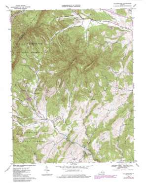
Collierstown Topo Map Virginia
To zoom in, hover over the map of Collierstown
USGS Topo Quad 37079g5 - 1:24,000 scale
| Topo Map Name: | Collierstown |
| USGS Topo Quad ID: | 37079g5 |
| Print Size: | ca. 21 1/4" wide x 27" high |
| Southeast Coordinates: | 37.75° N latitude / 79.5° W longitude |
| Map Center Coordinates: | 37.8125° N latitude / 79.5625° W longitude |
| U.S. State: | VA |
| Filename: | o37079g5.jpg |
| Download Map JPG Image: | Collierstown topo map 1:24,000 scale |
| Map Type: | Topographic |
| Topo Series: | 7.5´ |
| Map Scale: | 1:24,000 |
| Source of Map Images: | United States Geological Survey (USGS) |
| Alternate Map Versions: |
Collierstown VA 1967, updated 1969 Download PDF Buy paper map Collierstown VA 1967, updated 1978 Download PDF Buy paper map Collierstown VA 1967, updated 1986 Download PDF Buy paper map Collierstown VA 2011 Download PDF Buy paper map Collierstown VA 2013 Download PDF Buy paper map Collierstown VA 2016 Download PDF Buy paper map |
| FStopo: | US Forest Service topo Collierstown is available: Download FStopo PDF Download FStopo TIF |
1:24,000 Topo Quads surrounding Collierstown
> Back to 37079e1 at 1:100,000 scale
> Back to 37078a1 at 1:250,000 scale
> Back to U.S. Topo Maps home
Collierstown topo map: Gazetteer
Collierstown: Bridges
Herbert B Chittum Bridge elevation 377m 1236′Collierstown: Dams
Robertson Dam elevation 431m 1414′Collierstown: Populated Places
Collierstown elevation 379m 1243′Denmark elevation 406m 1332′
Effinger elevation 338m 1108′
Maple Grove elevation 414m 1358′
Collierstown: Reservoirs
Lake Robertson elevation 420m 1377′Robertson Lake elevation 431m 1414′
Collierstown: Streams
Blacks Creek elevation 372m 1220′Colliers Creek elevation 323m 1059′
Hayslette Creek elevation 381m 1250′
Linkswiler Branch elevation 395m 1295′
Sugar Creek elevation 343m 1125′
Toad Run elevation 333m 1092′
Waterloo Creek elevation 405m 1328′
Collierstown: Summits
Big House Mountain elevation 1111m 3645′Little House Mountain elevation 1032m 3385′
Rich Hill elevation 569m 1866′
Collierstown digital topo map on disk
Buy this Collierstown topo map showing relief, roads, GPS coordinates and other geographical features, as a high-resolution digital map file on DVD:
Western Virginia & Southern West Virginia
Buy digital topo maps: Western Virginia & Southern West Virginia


