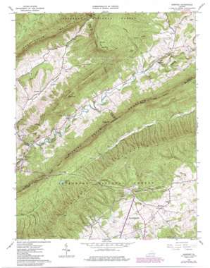
Newport Topo Map Virginia
To zoom in, hover over the map of Newport
USGS Topo Quad 37080c4 - 1:24,000 scale
| Topo Map Name: | Newport |
| USGS Topo Quad ID: | 37080c4 |
| Print Size: | ca. 21 1/4" wide x 27" high |
| Southeast Coordinates: | 37.25° N latitude / 80.375° W longitude |
| Map Center Coordinates: | 37.3125° N latitude / 80.4375° W longitude |
| U.S. State: | VA |
| Filename: | o37080c4.jpg |
| Download Map JPG Image: | Newport topo map 1:24,000 scale |
| Map Type: | Topographic |
| Topo Series: | 7.5´ |
| Map Scale: | 1:24,000 |
| Source of Map Images: | United States Geological Survey (USGS) |
| Alternate Map Versions: |
Newport VA 1965, updated 1966 Download PDF Buy paper map Newport VA 1965, updated 1978 Download PDF Buy paper map Newport VA 1965, updated 1986 Download PDF Buy paper map Newport VA 1998, updated 2000 Download PDF Buy paper map Newport VA 2011 Download PDF Buy paper map Newport VA 2013 Download PDF Buy paper map Newport VA 2016 Download PDF Buy paper map |
| FStopo: | US Forest Service topo Newport is available: Download FStopo PDF Download FStopo TIF |
1:24,000 Topo Quads surrounding Newport
> Back to 37080a1 at 1:100,000 scale
> Back to 37080a1 at 1:250,000 scale
> Back to U.S. Topo Maps home
Newport topo map: Gazetteer
Newport: Bridges
Sinking Creek Covered Bridge elevation 560m 1837′Newport: Gaps
Rocky Gap elevation 995m 3264′Stevers Gap elevation 877m 2877′
Newport: Parks
Newport Recreation Area elevation 571m 1873′Toms Creek Park elevation 612m 2007′
Newport: Populated Places
Alleghany Heights elevation 675m 2214′Countryside Estates elevation 688m 2257′
Huffman elevation 631m 2070′
Laurel Ridge elevation 714m 2342′
Meadow Brook elevation 648m 2125′
Meadow Run elevation 655m 2148′
Mount Tabor elevation 648m 2125′
Mount Tabor Village elevation 660m 2165′
Mountain View elevation 633m 2076′
Newport elevation 588m 1929′
Northside Park elevation 668m 2191′
Preston Forest elevation 782m 2565′
Woodbine elevation 650m 2132′
Newport: Reservoirs
Big Pond elevation 1095m 3592′Pandapas Pond elevation 655m 2148′
Newport: Ridges
Big Ridge elevation 733m 2404′Piney Ridge elevation 796m 2611′
Newport: Streams
Greenbrier Branch elevation 568m 1863′Laurel Creek elevation 624m 2047′
Sartain Branch elevation 723m 2372′
Newport: Summits
Clover Hollow Mountain elevation 962m 3156′Gap Mountain elevation 902m 2959′
Julian Knob elevation 960m 3149′
Keister Hill elevation 753m 2470′
Kelly Knob elevation 1141m 3743′
Lugar Hill elevation 736m 2414′
Wolf Knob elevation 784m 2572′
Newport: Trails
Brush Mountain Horse Trail elevation 758m 2486′Poverty Creek Horse Trail elevation 623m 2043′
Newport: Valleys
Clover Hollow elevation 559m 1833′Coal Bank Hollow elevation 620m 2034′
Happy Hollow elevation 662m 2171′
Wash Hollow elevation 576m 1889′
Newport digital topo map on disk
Buy this Newport topo map showing relief, roads, GPS coordinates and other geographical features, as a high-resolution digital map file on DVD:
Western Virginia & Southern West Virginia
Buy digital topo maps: Western Virginia & Southern West Virginia


