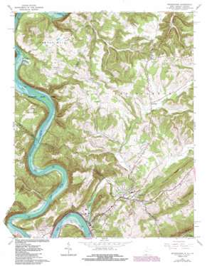
Peterstown Topo Map West Virginia
To zoom in, hover over the map of Peterstown
USGS Topo Quad 37080d7 - 1:24,000 scale
| Topo Map Name: | Peterstown |
| USGS Topo Quad ID: | 37080d7 |
| Print Size: | ca. 21 1/4" wide x 27" high |
| Southeast Coordinates: | 37.375° N latitude / 80.75° W longitude |
| Map Center Coordinates: | 37.4375° N latitude / 80.8125° W longitude |
| U.S. States: | WV, VA |
| Filename: | o37080d7.jpg |
| Download Map JPG Image: | Peterstown topo map 1:24,000 scale |
| Map Type: | Topographic |
| Topo Series: | 7.5´ |
| Map Scale: | 1:24,000 |
| Source of Map Images: | United States Geological Survey (USGS) |
| Alternate Map Versions: |
Peterstown WV 1965, updated 1966 Download PDF Buy paper map Peterstown WV 1965, updated 1977 Download PDF Buy paper map Peterstown WV 1965, updated 1984 Download PDF Buy paper map Peterstown WV 2011 Download PDF Buy paper map Peterstown WV 2014 Download PDF Buy paper map Peterstown WV 2016 Download PDF Buy paper map |
| FStopo: | US Forest Service topo Peterstown is available: Download FStopo PDF Download FStopo TIF |
1:24,000 Topo Quads surrounding Peterstown
> Back to 37080a1 at 1:100,000 scale
> Back to 37080a1 at 1:250,000 scale
> Back to U.S. Topo Maps home
Peterstown topo map: Gazetteer
Peterstown: Airports
Peterstown Airport elevation 486m 1594′Peterstown: Crossings
Shanklins Ferry (historical) elevation 439m 1440′Peterstown: Dams
Glen Lyn Bottom Ash Dikes Dam elevation 456m 1496′Peterstown: Falls
Wylie Falls elevation 446m 1463′Peterstown: Flats
Chestnut Flats elevation 613m 2011′Peterstown: Islands
Wylie Island elevation 444m 1456′Peterstown: Parks
Sherman Ballard Recreation Area elevation 450m 1476′Peterstown: Populated Places
Ballard elevation 646m 2119′Bozoo elevation 676m 2217′
Cashmere elevation 596m 1955′
Cloverdale elevation 649m 2129′
Gray Sulphur Springs (historical) elevation 511m 1676′
Lurich elevation 485m 1591′
Mandeville elevation 528m 1732′
Midway elevation 524m 1719′
Neponset elevation 620m 2034′
Peterstown elevation 495m 1624′
Rich Creek elevation 468m 1535′
Peterstown: Post Offices
Ballard Post Office elevation 649m 2129′Bozoo Post Office elevation 676m 2217′
Peterstown: Reservoirs
Glen Lyn Bottom Ash Pond elevation 456m 1496′Peterstown: Ridges
Chimney Ridge elevation 673m 2208′Peterstown: Springs
Red Sulphur Spring elevation 659m 2162′Red Sulphur Spring elevation 732m 2401′
Scott Branch Springs elevation 588m 1929′
Peterstown: Streams
Bee Branch elevation 515m 1689′Brush Creek elevation 480m 1574′
Cedar Branch elevation 435m 1427′
Cooper Branch elevation 449m 1473′
Cooper Branch elevation 448m 1469′
Crooked Run elevation 441m 1446′
Crooked Run elevation 561m 1840′
Ford Hollow Branch elevation 446m 1463′
Ford Hollow Branch elevation 443m 1453′
Limestone Creek elevation 455m 1492′
Rich Creek elevation 461m 1512′
Rich Creek elevation 462m 1515′
Roundbottom Creek elevation 443m 1453′
Scott Branch elevation 490m 1607′
Scott Branch elevation 491m 1610′
Smith Branch elevation 455m 1492′
Trigger Run elevation 510m 1673′
Peterstown: Summits
Powell Mountain elevation 726m 2381′White Tree Hill elevation 649m 2129′
Wylie Mountain elevation 675m 2214′
Peterstown: Valleys
Manuel Hollow elevation 482m 1581′Peterstown digital topo map on disk
Buy this Peterstown topo map showing relief, roads, GPS coordinates and other geographical features, as a high-resolution digital map file on DVD:
Western Virginia & Southern West Virginia
Buy digital topo maps: Western Virginia & Southern West Virginia


